A
Cultural History of Three
Traditional Hawaiian Sites
on the
West Coast of Hawai'i Island
Overview of Hawaiian History
by Diane Lee Rhodes
(with some additions by Linda Wedel Greene)
|
Chapter 7: Pu'ukohola Heiau National
Historic Site A. Setting of the Park 1. Village of Kawaihae The terraces of Pu'ukohola Heiau dominate the side of a prominent hill overlooking Kawaihae Bay. Despite the nondescript nature of the early village of Kawaihae, as recorded in the journals of early Euro-American voyagers to the islands, it has played a conspicuous role in Hawaiian history. In both prehistoric and historic times, its spacious natural harbor has distinguished it from the other coastal settlements of leeward Kohala, making it not only the safest mooring spot in that district, but also one of the best anchorages on the island of Hawai'i. Kawaihae is where Kamehameha confirmed his position as ali'i-nui of the island upon the death of his chief rival, and it remained his residence from about 1790 to 1794 while he planned the invasion of the other Hawaiian Islands. According to Marion Kelly, Kawaihae was a popular surfing area in ancient times. The name means "Water-of-Wrath" and refers to the battles over the life-giving waters of one of the springs in the area. Kelly states this water source reportedly was destroyed by harbor development, but it could also have been impacted by destructive high floodwaters in the gullies during heavy rains. According to trader William French, who owned a store in Kawaihae, the settlement was extremely active during the time of Kamehameha's reign. Its harbor and its proximity to the fertile uplands of Waimea ensured its status as an important stopover for many early European voyagers and merchantmen needing to make repairs and resupply their ships. Because King Kamehameha firmly controlled all trade and other intercourse with Euro-American ships, all sea captains arriving in the Hawaiian Islands had to obtain his permission before initiating any activities with his subjects. Therefore ships were constantly stopping at Kawaihae to pay their respects and gain his blessing when he was in residence. If he was not there, visitors contacted John Young, Kamehameha's business manager and governor of the island from 1802 to 1812, an important foreign political figure who, while he lived at Kawaihae, exerted a strong influence on its social, political, and economic life, and about whom more will be presented later. For all the above reasons, for many years Kawaihae served a crucial role in the importation of foreign goods, the distribution of local products, and the spreading of new ideas and mores during a time of great change for the Hawaiian people. After Kamehameha's death, it was to this place his son returned from the royal residence at Kailua to unite his supporters, formulate his policies, and consecrate his new leadership role.
2. Historical Accounts of Kawaihae Bay Area The earliest European observers of Kawaihae Bay were members of Captain James Cook's exploratory and scientific expedition. Arriving at the mouth of the bay in February 1779, they were little impressed, Captain James King noting that
A month later, revisiting the harbor after Cook's death, King still found nothing of particular interest:
George Vancouver, captain of the Discovery, visited Kawaihae in February 1793 and found a watering place
Going on shore to visit the inhabitants, Vancouver noted that
Captain Richard J. Cleveland, anchored off "Toiyahyah" Bay in 1799, described the approach of a large number of canoes carrying hogs, potatoes, taro, cabbages, watermelons, muskmelons, sugarcane, and a variety of other produce for trade. A local chief came on board to maintain order and regulate the number of persons allowed on the vessel at one time. He also acted as a broker for the crew and as a facilitator for the bartering process. Isaac Iselin, supercargo on the Maryland, visited Kawaihae in the early 1800s:
Iselin also mentions visiting "several salt ponds or pans, the arrangement of which displays much industry and ingenuity." Jacques Arago, draftsman on the French expedition (1817-20) under command of Louis de Freycinet (in the corvette Uranie), noted that
De Freycinet described the town in terms equally unflattering:
3. Historical Appearance and Activities of Kawaihae a) Fishponds Frenchman Louis Duperrey, an officer of the de Freycinet expedition, drew a map of Kawaihae Bay in 1819, showing about ninety structures along the shoreline (Illustration 27). The main portion of the settlement contained three rows of houses parallel to the coast. The first group abutted the shore, with the last row lying near the base of the Kohala Mountain slope. This map also delineates a small inland body of water, probably one of two fishponds that existed there. One was located near the homestead of John Young at the mouth of Makahuna Gulch; the other lay near the old salt pans to the north. Historian Russell Apple has determined that the Makeahua pond existed from before 1819 at least through 1848.
b) Salt Pans The salt pans constructed for the extraction of salt from sea water were an extremely important aspect of Kawaihae's subsistence — perhaps its major industry for many years. Because of its shoreline's lack of fertility, Kawaihae was always foremost a fishing village; in the mid-1830s it was reportedly the best place to buy fish on the entire island. This distinction resulted not only from its abundant marine resources but also from its status as an important trading center to which people from other communities along the Kohala coast brought their catches. The ready availability of salt there allowed the immediate preservation of excess fish for use as trade items or for future local need. The locals traded this salt to Kona as well as other sections of Kohala for the necessities they lacked — such as cultivated food and kapa. Hawaiian salt, used to season and preserve fish and meat, was one of the first items of exchange between the natives and foreign fur traders in the early nineteenth century. Extensive areas in certain parts of the islands were reserved for the production of this commodity. On Hawai'i Island, Kawaihae boasted the largest salt pans. Hawai'i exported salt from around 1840 to 1881, reaching a peak production about 1870. Hawaiian salt was later used in curing hides in addition to salting meat, requiring construction of larger pans as the Waimea cattle industry expanded; these were destroyed by a tidal wave in 1946. According to Marion Kelly, Kawaihae informants told her the earlier salt pans had been destroyed during construction of the modern harbor. As Reverend William Ellis traveled around the island of Hawai'i in 1823, he visited Kawaihae twice, recording 100 houses there in 1824. Ellis mentioned several interesting activities and sites in Kawaihae, including some warm springs a short distance south of the heiau, in which he enjoyed a refreshing bath:
Ellis also described salt production at Kawaihae, noting that Hawaiians partook of this item liberally with their food besides utilizing large amounts to preserve their fish catches:
c) Sandalwood Trade On his second visit to Kawaihae, Ellis stayed with John Young, where, one morning
The sandalwood trade was another extremely important industry in this area — a commercial activity that reached its peak in the 1820s. At this time the Kohala Mountain forests were abundant, reaching almost to the Kawaihae shore in 1815. John Young oversaw the measuring and loading of logs, while, according to Ellis, thousands of natives were forced to cut and haul timber, penetrating ever deeper into the interior as supplies dwindled. This intensive business venture denuded the forests and precipitated their retreat inland. The prospering herds of wild cattle and goats in the Waimea area prevented new growth from surviving, as did the diversion of streams to support the community there. All these factors contributed to Kawaihae's appearance as a desolate place. 4. Missionary Activities at Kawaihae American missionaries arrived in the islands in 1820. During a brief sojourn at Kawaihae they met some members of Hawaiian royalty, including two of Kamehameha's widows. The Reverend Hiram Bingham also visited Pu'ukohola Heiau with the high chief Kalanimoku and left a description of the structures that will be presented in the next section of this report. Because the new king was living in Kailua at this time, however, the missionaries' ship proceeded on down the coast to ask his permission to begin their work.
Kawaihae was the site of one of the first mission stations in the Hawaiian Islands, although it was only briefly looked after by Elisha Loomis beginning in 1821. Kawaihae and Puako were ultimately included in the area served by missionaries Dwight Baldwin from 1832 to 1835 and Lorenzo Lyons from 1832 to 1876. Lyons landed at Kawaihae in 1832 before proceeding to Waimea to establish a station. He noted that Kawaihae was "about as desolate a place as I have ever seen, nothing but barrenness, with here and there a native hut." His Waimea parish eventually included the districts of Kohala and Hamakua, making it the largest mission station in Hawai'i. During his tenure, Lyons was responsible for the erection of fourteen churches, including one at Kawaihae. Kawaihae had supported some type of meetinghouse since the earliest days of the Protestant mission, though it amounted to little more than a rude grass sanctuary. In 1843, however, the parish began construction of a stone meetinghouse, probably covered by a thatched roof. Stones for the walls were found nearby, while coral collected from the beach was burned to produce a lime for mortaring. The final dedication ceremony on January 13, 1859, involved a procession, prayers, speeches, and songs. Toward the end of the service, the parishioners marched over to the old heiau of Pu'ukohola where they prayed and sang. This church underwent renovation in 1884 and repairs in 1903; it was torn down in 1959. 5. Cattle Industry in the Kawaihae-Waimea Area In time it was the lush pastures of the upper slopes of Kohala Mountain that sustained the Kawaihae economy. Travel between the two areas was possible via a number of trails that led from the seacoast, past periodically cultivated agricultural plots, to the Waimea Plain. In the early 1820s three major population centers existed there, about two miles apart, at Keaalii, Waikoloa, and Pu'ukapu. After the supplies of sandalwood and pulu disappeared, resulting in the failure of those business enterprises, South Kohala turned to cattle for its livelihood. The cattle industry had begun in the early 1800s with government-controlled bull hunting. An American who greatly impacted this activity was John Palmer Parker, a seaman who came to Kawaihae in 1815 and then moved to Waimea. Enlisted to hunt wild cattle on the slopes of Mauna Kea, he was to thin the herds, descended from cattle introduced by Vancouver, that had multiplied so rapidly that they were a danger to people and destructive of the landscape and cultivated upland fields. The government and king, who jointly owned all the wild cattle on Hawai'i and sold or leased slaughter rights to private parties, encouraged the capture of these animals to procure beef, hides, and tallow. Because Hawaiians did not yet eat beef, it was the needs of the whalers, arriving in great numbers in the 1840s, that spurred this enterprise. Parker soon built up a thriving business with foreign, and later interisland, trading vessels in meat treated with salt from Kawaihae and tanned hides. Over the next thirty-two years, Parker expanded his activities, importing Spaniards from Peru as ranchhands and shipping out hides, tallow, and soap. Parker received two acres of land on the Waimea Plain from King Kamehameha Ill in 1847; this landholding ultimately developed into the famous Parker Ranch. Exporting its cattle became Kawaihae's principal activity. The wild descendants of Vancouver's original cattle comprised the herds of Hawai'i's first ranches prior to 1830. After that time, however, as a flourishing by-products industry took hold, most wild cattle were killed, and imported animals were brought in to stock the ranches. The cattle industry slowed in the late 1830s and early 1840s due to overkilling. By 1850, however, cattle raising was again a thriving industry in Waimea, with cattle driven to Kawaihae for shipment to Honolulu's slaughterhouses. The old road between Waimea and Kawaihae is supposedly the route of the historical Parker Ranch cattle drives. More modern cattle holding pens are located across from the small boat harbor; the massive rock walls near the present canoe club are said to be the remnants of older corrals where cattle were held until shipment.
6. Agricultural Activity in the Kawaihae-Waimea Area A slight decline in Hawaiian agricultural production began in the 1830s. Author and journalist James J. Jarves described Kawaihae in the late 1830s as
Agricultural activity revived somewhat in the late 1840s and early 1850s, primarily due to the demand for sweet and Irish potatoes. Although the former had always been a much-sought-after item for ships' stores, it was not until the early 1830s that Irish potatoes were also cultivated in Hawai'i. Increased whaling activity after 1840 brought new demands for both types. Another short-lived increase in potato production began in 1849 to help make up for a lack of that vegetable in California during the Gold Rush. This trade had diminished by 1852, although that with whalers continued for several more years. In 1853 Edward T. Perkins, anchored in a ship off Kawaihae Bay, judged this to be
By 1857 Kawaihae was described as an important port shipping produce from the rich uplands of Waimea, one of the finest agricultural districts in the islands:
Other exports included fresh beef, pork, fowl, beans, wool, bullock hides, goatskins, and tallow. By the mid-1800s, then, Kawaihae hosted an active port, where visiting ships low on provisions traded foreign goods for produce, sandalwood, pulu, firewood, fresh water, and local salt. While there, the ships' officers usually met with any high-ranking personnages who happened to be in the area. An 1880s photo of the Kawaihae landing (Illustration 30) shows a group of buildings that may include William French's warehouse for storing sandalwood, wool, salted beef, and hides to be shipped to Honolulu or California in the 1830s and 1840s. French obtained property near the landing from Governor Kuakini in 1838 for the storage of cargo.
7. Decline of Kawaihae The Reverend Lorenzo Lyons noted in 1841, while preaching in Kawaihae, that its population stood at 726 people, 300 less than the previous year. His letters attribute this decrease to its being such a "wretchedly poor place," offering so little to eat that families were forced to relocate to more fertile regions. Throughout the 1800s, the population of the Waimea-Kawaihae area seems to have been in decline. It probably fluctuated due to a number of circumstances, including people moving periodically to certain areas for specialized public work projects, such as coming in from all over Kohala to build Pu'ukohola Heiau or to carry sandalwood from Waimea to Kawaihae Bay. Other population shifts would have involved families visiting relatives elsewhere for periods of time; chiefs and their entourages moving from site to site, always attracting the curious and various hangers-on; neighboring residents coming in to watch the arrival of ships, anxious to see the foreigners and engage them in trade; and residents moving to other places for new and better commercial opportunities. In addition to this constant movement, reduced fertility and increased mortality changed the population figures. A smallpox epidemic in Kawaihae in 1853, for instance, took half the population. Isabella Bird Bishop, visiting Kawaihae in the 1870s, was able to make the small town seem appealing despite the slow tempo of its life:
By 1890 Henry Whitney reported that:
Caspar Whitney verified this view of Kawaihae's decline in 1899:
8. "Modern" Kawaihae Village Not until modern times, with the dredging of its harbor and the opening of luxury resorts, did the forgotten village of Kawaihae again become a prominent site on the Kohala coast. In 1949 construction of a deep-draft harbor was recommended for the bay, which by that time was a small port shipping sugar, steers, pigs, and sheep to market on interisland vessels. In 1957 a contract was let to build causeways, a dike, and a revetment; the new deep-water port of Kawaihae Harbor was finally completed in 1959. Three years later the Corps of Engineers decided to widen the harbor's entrance channel and its basin, extend the existing breakwater, and construct a small boat harbor. By that time the Corps and the Atomic Energy Commission had begun a joint research program focusing on the use of nuclear explosives for construction purposes. Some of the types of projects amenable to nuclear excavation included water channels, highway cuts, harbors, and dams. The army's Nuclear Cratering Group was anxious to try chemical high explosives in excavating the small boat harbor and entrance channel at Kawaihae. "Project Tugboat" would be the army's first major construction project using that method of excavation. Some local opposition arose, concerned about detrimental impacts on marine life and on historically significant structures such as the nearby heiau. Before setting off the explosions, engineers braced the walls of Pu'ukohola Heiau and placed a seismograph next to the structure to monitor movement. Three phases of detonations were required to accomplish the job, which also involved construction of an 850-foot-long breakwater to protect the new basin. The project was considered a complete success, but expensive. No known damage occurred to historic structures. Today Kawaihae Bay and its coastline differ drastically from the views described in historical journals. In Young's day, the late eighteenth and early nineteenth centuries, the original hardwood forests stretched almost to the beach. Freshwater streams flowing down gulches from Kohala Mountain provided the water supply of Kawaihae and potable water for ships. Ultimately logging activities related to the sandalwood trade and to the repair of visiting ships, clearing for agricultural terracing, and uncontrolled cattle grazing and tree removal caused the forest to recede. As streams dried up, erosion intensified, creating a semi-barren desert environment. While the town evolved into a specialized port for salt and cattle-related products, many of its residents left for the bustling major ports such as Lahaina and Honolulu. During excavation of the harbor, the dangerous coral reef, which formerly stretched just under two miles south from the area of the town, was cut and scraped and the dredged material formed into a landfill to support the harbor terminal facilities, oil storage tanks, and other buildings. Excess material was stockpiled and its outer edge revetted with stones. Kawaihae village itself also little resembles the settlement seen by early European explorers and merchants. It consists of frame dwellings, a few stores, and other local businesses. Kawaihae is now a major shipping center for raw sugar. Structures in the harbor facility include storage tanks for oil and molasses, a bulk sugar warehouse and conveyor system for loading ships, a metal warehouse, a service terminal, and a concrete bulk chemical warehouse. The town is also the major supply point for Pohakuloa Training Area. Development farther south along the coast includes Spencer Beach County Park, residences, and the Mauna Kea Beach resort hotel. Two highly visible structures in Kawaihae served as landmarks for ships heading into Kawaihae Bay in the early historic period. One was the grave of George Hueu Davis, son of Isaac Davis. The other was the grave of George W. Macy, a sea captain who was in business with an early Waimea merchant. Macy's grave was described as a "conspicuous white obelisk" on a hill behind the village. Significant prehistoric and historical manmade structures around Kawaihae include numerous stone features of early Hawaiian civilization such as agricultural enclosures, homesites, fishing shelters, and graves. The ruins of John Young's Kawaihae home overlook the bay, and two structures of extreme importance in Hawaiian history — Pu'ukohola and Mailekini heiau — still stand quietly by the sea. The history, appearance, and significance of these structures will be discussed in the next section.
B. Pu'ukohola Heiau 1. Traditional Construction History a) Hawai'i Island Politics at Euroepan Contact At the time Cook discovered the Hawaiian archipelago, Kalani'opu'u ruled as paramount chief of the island of Hawai'i and the Hana District of Maui. During the fierce interisland warfare of this period, the young chief Kamehameha highly distinguished himself as a warrior in Kalani'opu'u's army. Before Kalani'opu'u died in 1782, he designated his son, Kiwala'o, to succeed him as high chief; in accordance with the custom in those days of splitting power, he also named his nephew Kamehameha custodian of the state god Ku-ka'ili-moku. Kamehameha first revealed his political ambitions shortly after this by offering up a human sacrifice — the leader of a failed uprising — usurping Kiwala'o's prerogative as designated future ruler. As punishment for this infringement, Kalani'opu'u dismissed Kamehameha from his court. Hostilities between the rival supporters of the son and the nephew resurfaced upon Kalani'opu'u's death. At the battle of Moku'ohai, Kona, in 1782, Kiwala'o met his death at the hands of Kamehameha's supporters. This left his younger brother Keoua Kuahu'ula as the chief contender with Kamehameha for sovereignty of the island. The situation was further complicated when Keawemauhili, the chief of Hilo and Keoua's uncle, declared his independence, splitting the island into three rival factions.
b) Kamehameha Begins His Bid for Power Kamehameha, reigning over the western part of the island, with its favorable anchorages at Kailua and Kealakekua Bay, gained a distinct advantage over his foes by acquiring not only the benefits of European ideas and military strategies, but also advanced technology such as arms and gunpowder. By 1790 he had managed to acquire guns, light cannon, and an armed schooner, in addition to the advice and technical expertise of two European seamen, John Young and Isaac Davis. Setting aside for the moment his ambitions on his own island, however, Kamehameha decided to invade Maui, where he defeated its defending army but failed to capture the important chiefs. When Kamehameha pushed on toward Moloka'i, Keoua took advantage of his absence, and, defeating Keawemauhili, invaded his other rival's territory, laying waste Hamakua and Kohala. Quickly returning to defend his lands, Kamehameha secured them but did not defeat Keoua and decided to again invade Maui. It was during Keoua's retreat to his home district of Ka'u that part of his army, passing near the summit of Kilauea volcano, was suffocated during a rare explosive eruption — a signal to many observers that the gods favored Kamehameha. Although weakened psychologically as well as physically by this tragedy, Keoua remained tenacious and managed to hold his own against Kamehameha's forces for several more months.
c) Kamehameha is Instructed to Build a Heiau Meanwhile, from Moloka'i, Kamehameha had sent his aunt to Kaua'i to consult a kahuna as to what the future course of his actions should be in order to take possession of Hawai'i and the rest of the islands. Instead, she found on O'ahu the famous prophet of Kaua'i—Kapoukahi. This man., who according to the historian John Papa I'i was skilled in selecting propitious sites for heiau, told Kamehameha that if he rebuilt the temple at Pu'ukohola ("hill of the whale") near Kawaihae and rededicated it to honor Ku-ka'ili-moku, he could conquer the rest of the islands. Kapoukahi supposedly prophesied that "War shall cease on Hawaii when one shall come and shall be laid above on the altar (lele) of Pu'u-kohola, the house of god." A few sources state that construction of this heiau had been an intention of Kamehameha for some time. Kamaka Paea Kealii Ai'a writes that "From time to time the High Priest of Kohala urged Tamaahmaah to build a heiau at Puukohola, Kawaihae, for which he would gain supremacy of Hawaii." The Reverend Herbert Gowen states that Kamehameha had promised to build it [heiau of Pu'ukohola] years before this, but had evidently been trying carnal weapons first and leaving spiritual means as a kind of last resource." One part of the legend also states that Kamehameha first intended to refurbish and rededicate Mailekini temple, on the slope below Pu'ukohola. But Kapoukahi, who had joined Kamehameha's staff as royal architect, suggested that a new temple on the summit would be more appropriate and provide greater benefits. According to Thomas Thrum, Kapoukahi instructed Kamehameha "to build a large heiau for his god at Puukohola, adjoining the old heiau of Mailekini. . . . Thrum continues:
Only archeological excavations could provide definitive evidence on whether Pu'ukohola Heiau is a new structure or a renovation of an older, abandoned temple. According to Hawaiian mythology, the original temple of Pu'ukohola was consecrated by the god Lono about 1580. Fornander gathered some data on this subject from native accounts:
Fornander states that the long years of warfare and strife were becoming tiring to Kamehameha, who "stood no nearer to the supremacy of Hawaii than he did on the day of Mokuohai." Because neither spears nor guns had succeeded in annihilating Keoua, Kamehameha decided to follow the seer's advice "and the construction of the Heiau on Puukohola was resumed with a vigour and zeal quickened, perhaps, by a consciousness of neglected duty."
d) Construction of the Heiau Begins According to Samuel Kamakau, Kamehameha
According to Historian Kuykendall, basing his information on Kamakau and Fornander, in 1790
Fornander states that an aged informant from Kawaihae had actually helped carry stones for the construction of Pu'ukohola Heiau. This man painted a vivid picture of thousands of people encamped on the hillsides and described the careful regulation of their eating periods, work shifts, and break times. He also mentioned the large number of chiefs present and the numerous human sacrifices required at various stages of construction.
e) Warfare Interrupts Construction A revolt on the islands of Maui, Lana'i, and Moloka'i, followed by an invasion of North Kohala by the previously conquered chiefs of those islands, interrupted work on Pu'ukohola Heiau. Possibly the news that Kamehameha was building a major temple unsettled his rivals to such an extent that they hoped that even if they could not kill the ambitious chief, they could at least keep the temple from being ritually perfect by interfering with its erection and the attendant ceremonies. If the construction process displeased Ku-ka'ili-moku, Kamehameha's foes reasoned, it might eliminate or reduce the spiritual power exuded by the heiau. A sea battle in 1791 near Waipi'o Valley raged, with both Kamehameha and his foes utilizing muskets and cannons operated by foreigners. Kamehameha's fleet included, in addition to double canoes armed with cannons, his warship Fair American. Young and Davis commanded his artillery. This battle of Kepuwaha'ula'ula, or "the red-mouthed gun," referring to the repeated firing of cannons and muskets as well as possibly to the carnage, resulted in defeat of the invading forces. Apple states that this was Hawai'i's "first and last real sea battle using Hawaiian canoes and Western gunpowder." f) Kamehameha Becomes Undisputed Ruler of Hawai'i Island Kamehameha then resumed construction of his heiau, a massive terraced and walled hilltop platform built of mortarless, waterworn lava rocks and boulders. Measuring about 224 by 100 feet, it contained walls on each end and the landward side. The side toward the sea remained open. Three narrow, terraced steps down the hillside to the west enabled the interior to be seen from the sea. The temple was finished in the summer of 1791. It has been written that Keoua was enticed to the dedication of Pu'ukohola Heiau by a ruse, in the belief that he and Kamehameha were to arrange a treaty of peace. Given the past history of the two men, however, it is hard to believe that Keoua would have considered this a possibility. Keoua and his retinue proceeded to Kawaihae amidst considerable pomp and pageantry. According to legend, the journey had "the appearance of a fatalistic resignation to the doom which he clearly recognized as a possible issue of his journey to Kawaihae." Samuel Kamakau relates that
Keoua placed the reminder of his companions in a canoe with his younger brother Kaoleioku. Kamehameha, resplendent in feather cloak and helmet, stood on the shore below the heiau to greet his visitors. Versions differ as to what happened next, but at some point, while Keoua was disembarking, someone among Kamehameha's retainers killed him and the others in his canoe; Kamehameha did, however, prevent the killing of Kaoleioku and others in the party. Fornander states that prior to Keoua's arrival, "the umu had been prepared and was red hot. Keoua was then roasted" before he and the other victims were offered up as sacrifices to celebrate this great victory. Many questions have been raised as to why Keoua willingly entered the camp of so bitter an enemy. Fornander believed that the defeat of Kamehameha's enemies in the battle of Kepuwaha'ula'ula probably influenced Keoua to try to negotiate with Kamehameha. Perhaps Keoua realized the political and religious significance of this heiau and surmised that with its completion his fate was sealed. Whether his death occurred by or against Kamehameha's wishes is also disputed. After critically examining the statements of a variety of early native and foreign writers on the subject, Fornander concludes that
g) Kamehameha Unites the Hawaiian Islands Whether planned or not, the assassination of Keoua gave Kamehameha undisputed control of Hawai'i Island by 1792. In early 1795 Kamehameha took Maui, Lana'i, and Moloka'i. With the conquest of O'ahu that year, Kamehameha's aggressive military policy succeeded in bringing all the islands but Kaua'i under his control. In 1810 that island's paramount chief acknowledged Kamehameha's supremacy, completing the consolidation of the islands into the Kingdom of Hawai'i, which Kamehameha ruled until 1819 and his descendants until 1872. Although the monarchy was overthrown in favor of a republic in 1894, it established the foundation for the future state of Hawai'i. B. Pu'ukohola Heiau (continued) 2. Historical Descriptions a) Introductory Remarks Considering that there were foreigners in the vicinity, and that the construction process for Pu'ukohola Heiau must have been quite impressive in terms of the number of people and the rituals involved, the paucity of firsthand accounts of this event or of the structure's appearance at the time of construction is disappointing. Because this was considered a very sacred temple, however, there really existed no opportunity for detailed Western observances until after the abolition of the kapu system. b) Archibald Menzies, 1792-94 The first Western account we have of Pu'ukohola Heiau is that of Archibald Menzies of the Vancouver expedition. It is important because he viewed the structure soon after its construction while it was still being used for ceremonial purposes and thus was still regarded with fear by the common people:
Although it is difficult to understand how Menzies could describe this as a "little" temple, his description is probably a good indication of the heiau's original appearance. Note that he does not mention wooden images, which were usually an integral part of the furnishings of a luakini and the carving and erection of which have been described in the accounts of this temple's construction. Because during this time Kamehameha was still in the process of reconquering and subjugating the other Hawaiian Islands, it would appear that the twelve skulls of those who dared oppose him were being displayed as a warning to others and as a sign of Kamehameha's patronage in military matters by Ku-ka'ili-moku. c) Samuel Patterson, 1804-5 The next description, although scanty in comparison, is by the American seaman Samuel Patterson, who chronicled his travels in a merchantman during the period 1800 to 1817. He noted about 1804 that the Hawaiians
What sort of "roof" Patterson is referring to is unclear, although presumably he simply means that the skulls were positioned on the platform or on the walls surrounding the platform area. d) Otto von Kotzebue, 1816-17 During 1816-17, Otto von Kotzebue, commander of the Rurick, led a Russian expedition in search of a northeast passage that visited Hawai'i in the course of its travels. His description of Kawaihae Bay adds little, except to note that "We saw here several morais, which belong to the chiefs of these parts, and may be recognized by the stone fence, and the idols placed in them." e) Louis de Freycinet, 1819 In 1819 an official French scientific and political expedition commanded by Captain Louis de Freycinet visited the islands shortly after the death of King Kamehameha. Jacques Arago, the ship's artist, left a very descriptive journal which is highly useful for some types of information:
This indicates that Pu'ukohola Heiau was used regularly up through Kamehameha's lifetime for religious services and that human sacrifices were a part of those services. Sometime between 1804 and 1819, it appears, the skulls of Keoua and his followers were removed and the customary wooden images became the dominating feature. This might have occurred around 1810 when the chief of Kaua'i acknowledged Kamehameha as supreme ruler, completing the formation of the island kingdom. At that time the warning symbolized by the skulls and the warlike atmosphere they generated would no longer have been necessary.
f) Missionaries Hiram Bingham, Henry Cheever, 1820 In 1820 Protestant missionaries arrived in Hawai'i on board the brig Thaddeus. They landed first in Kawaihae, knowing that was one of the favorite residences of King Kamehameha as well as the home of John Young, known to all sea captains as one of the king's trusted and very influential advisors — someone whom it would pay to have on their side. Learning upon their arrival of the death of Kamehameha and the abolition of the old religion, the missionaries were eager to proceed to Kailua for an audience with the new king. During their brief stay in Kawaihae, however, they had time to briefly reconnoiter. Missionary Hiram Bingham stated that:
This description is also found in a journal of the Sandwich Island mission begun on board ship and possibly co-authored by Bingham, who adds in that document that the terraces "made convenient places for hundreds of worshipers [sic] to stand while the priest was within offering prayers and sacrifices of abomination." Whether Bingham was told that people stood on the terraces during services or simply assumed that the terraces were used in that way is unknown. He continues:
According to this account, therefore, Pu'ukohola Heiau was destroyed and abandoned at the time of the abolition of the kapu system by Liholiho just as were others throughout the islands. This account also suggests that Mailekini was not the scene of human sacrifices. Despite Pu'ukohola Heiau's significant personal importance to Kamehameha, it would seem that his son did not view it with any particularly strong attachment, and certainly the usefulness of the heiau was over. However, when Liholiho returned to Kawaihae after the death of his father, he reportedly reconsecrated the heiau at Puukohola, following the traditional method of announcing one's new role as leader. Missionary Henry Cheever, sailing by the west coast of Hawai'i Island, mentioned: "We passed in the afternoon the Bay of Kawaihae, and saw the huge heiau which Kamehameha II. went to consecrate at the death of his father. . . " Because this was the structure that supposedly provided Kamehameha with the power to become king, perhaps this ritual was seen as necessary to pass on the former ruler's power to his son. Marion Kelly speaks of Kawaihae as "the place where Kamehameha II returned after the death of his father to seek consolidation of his forces and consecration of his leadership role." Kawaihae and Pu'ukohola Heiau appear to have retained some of their former spiritual and political significance at least immediately following Kamehameha's death, but having performed this last service in sanctifying Liholiho's role as king, the heiau structures were destroyed with the abolition of the kapu system. g) Reverend William Ellis, 1823 The account of Pu'ukohola Heiau considered the most informative of these early sources is that by the Reverend William Ellis. Although very lengthy, it is presented here in its entirely because of the wealth of construction details. Much of the data on ritual ceremonies and procedures interspersed with the physical description was probably supplied by Ellis's native guides, who should have had a good knowledge of what went on at the site in more recent times. William Ellis was part of a delegation of Honolulu missionaries that made a tour of the island in 1823 to look for suitable locations for mission stations. Others in the group included Asa Thurston, Artemas Bishop, and Joseph Goodrich. While staying at Kawaihae, Ellis visited the temple of Pu'ukohola:
h) Reverend Artemas Bishop, 1826 In November 1826 the queen regent Ka'ahumanu, residing on O'ahu, visited the island of Hawai'i for about two months. The Reverend Artemas Bishop accompanied her when she stopped at Kawaihae:
i) John Kirk Townsend, 1834-37 John Kirk Townsend, an American ornithologist, embarked on a journey that included Hawai'i during the years 1834-37. Anchoring off Kawaihae, he went ashore, visited John Young's widow, and also took a look at Pu'ukohola Heiau. He noted, probably based on local information, that it had not been used as a temple since the abolition of the kapu system:
Townsend states that victims were sacrificed on this platform, "the gods standing around outside in niches made for their accommodation." j) James Jarves, 1837-42 James Jarves published a history of the Hawaiian Islands in 1843 in which he described Pu'ukohola as being
k) Gorham D. Gilman, 1844-45 Gorham D. Gilman, in his journal of a trip to Hawai'i during 1844-45, visited Kawaihae and
l) Account, 1847 In June 1847 a party of men voyaged to Hawai'i to visit Kilauea caldera. On the way they landed in Kawaihae Bay:
This is the first mention of an underground passage on Puukohola, although it possibly simply refers to a lower walkway or passage in the platform area or along the east wall that some observers mistook for an underground passage that had formerly been covered over. m) Samuel S. Hill, 1848 Samuel S. Hill, English author and traveler, arrived in Hawai'i on the Josephine in 1848 and visited Kawaihae's archeological sites:
This account seems to suggest that a large number of worshippers could be found in the temple during certain rites. Whether or not these attendees spilled over onto the terraces is not known, although the missionary accounts presented earlier also mentioned this possibility. This account also suggests low standing walls within the interior dividing the platform into separate areas used either for ritual purposes or for priests' quarters. n) Charles-Victor Crosnier de Varigny, 1855 Charles de Varigny provides what he states is an account of a visit to Pu'ukohola Heiau in 1855, but one needs to be careful in reading it because he confuses several bits of data with the construction of Mo'okini Heiau in northern Kohala. He states that the heiau about a mile from Kawaihae "is the largest and most intact still in existence in the archipelago. Its length is 350 feet, its width 150. The walls are 50 feet thick at the base, 8 at the top, and not more than 20 high." He continues,
o) Lady Jane Franklin, 1861 Lady Franklin, widow of the renowned Arctic explorer Admiral Sir John Franklin, visiting Kawaihae in 1861, went to see Pu'ukohola Heiau and described it as
This certainly provides an explanation for the three terrace levels, but again it is difficult to know whether this information is accurate. The grandson of Isaac Davis accompanied Lady Franklin on this visit to the heiau, but whether he supplied the details on its construction and use is unclear. p) Clara K. Whelden, 1864 The wife of the master of the whaling bark John Howland, out of New Bedford, Massachusetts, passed through Kawaihae Bay in 1864, but noted only that
q) Isabella Bird, 1873 Isabella Bird, traveling in Hawai'i in 1873 for her health, so benefitted from the climate that she stayed for nearly seven months. During that time she traveled around on horseback exploring local sites. Her description of Kawaihae was quoted earlier, but she also visited the nearby heiau on Puukohola, which stood "gaunt and desolate in the thin red air," entering it through a narrow passage between two high walls. Describing the structure as an irregular parallelogram, 224 feet long and 100 feet wide, she added that
Much of this information was probably gained from Mrs. Bishop's companions and merely repeats the interior arrangement described by Ellis and other earlier visitors. Whatever fact it was originally based on, the information had been passed down that the temple terraces were for the accommodation of observers of the ceremonies within.
r) Frank Vincent, Jr., ca. 1875 Traveler Frank Vincent, Jr., mentioned Pu'ukohola Heiau in his 1870s travelogue but provided nothing new in terms of a description. He did state that "Human sacrifices were offered in this temple as recently as the early part of the present century" — a fact he was undoubtedly told by local residents. However, that observation seems to be corroborated by Jacque Arago's statement that human sacrifices were practiced as late as 1809. s) John F. G. Stokes, 1906 In 1906 the Bishop Museum of Honolulu sent John F. G. Stokes to Hawai'i Island to conduct archeological research on temple remains. The work was part of a research design for Hawaiian archeology, focusing on recording and making plan drawings of temple structures on the various islands to document changes in construction style. Stokes noted that Pu'ukohola Heiau incorporated terrace, platform, and wall features, all with a partial veneer of ala, or waterworn stones. The walls on the north, east, and south were composed entirely of slightly rounded ala, while their narrow upper surfaces were paved with flat ala. The terraces to the west were filled in with rough stone like that found nearby, but faced with rounded ala and paved with flat ala. "Choicer" stones had been used for the large area of low pavement just to the south of the middle of the heiau. A large platform containing several divisions, suggesting house sites, occupied about one-third of the interior in the northeast quarter of the structure, rising about 4-1/2 feet above the floor. It was faced with ala stones and roughly paved with stones on the east and south; smooth coral fragments covered the northwest half. In the middle of the platform, leading in from the west, was a roadway of flat ala, two stones wide, ending in a single large ala convex on its upper surface. A ledge 2 feet high and 2-1/2 feet wide ran around the west side and south end of this platform. Another platform at the southern end of the heiau stood three feet high; also paved with ala stones, it appeared to have been disturbed. Five pits existed in the platform, one in the southeast corner and the others forming a rough line near and parallel to the northern face of that platform. A local informant told Stokes the pit to the west was the lua pa'u and the lele had stood near it, on the western edge of the platform. Stokes was not sure, however, if these were ancient or modern pits because of the amount of disturbance. Below this last platform and the low, smooth pavement described earlier, Stokes found a heap of loose stones in a sort of crescent form, which he did not think had been a later intrusion. On the eastern edge of the highest terrace to the west lay a strip of earth five feet wide, only a few inches below the level of the terrace pavement. Passages north and east of the main interior platform, between it and the outer walls, had been filled in by fallen stones. He did not think these had originally been paved. The entrance to the top of the heiau was over a stone pavement inclining upward and to the south-southwest. East of the entrance a bench had been built into the slope of the west end of the northern wall, about 2-1/2 feet above the terrace pavement — a niche for a "guardian idol" he ventured. The heiau was constructed so that, although the west side was open, one could not get a close view of interior proceedings from the outside. According to local information, Stokes noted, the smooth ala pavement was for dancing; also, a stone idol used to stand on the middle terrace and a wooden one on the lower terrace. Stokes also mentioned that an elderly local native had told him that the body of Keoua had been cooked in an underground oven located on a ridge about fifty feet west of the northwest corner of Pu'ukohola Heiau. In another group of notes, Stokes described the two small walls stretching from the corners of Pu'ukohola to the southwest and northwest, the latter beginning just east of the entrance. He suggested these delineated the limits of the sacred ground connected with the temple in ancient times. In other miscellaneous information, he noted that the terraces, three in number, bulged outward, following the contours of the ground. The lower two were narrow, but the upper one broadened out as the main floor of the heiau. He also said that small idols had been found hidden within the structure and conjectured that the pits in the south end could have resulted from digging for other hidden statues. But he believed that the four pits arranged in a line could have been enlargements of holes for large idols. Stokes's plan of Pu'ukohola Heiau placed the 'anu'u and lele according to Ellis's description. The site of the drum, or king's house, he placed on the south projection of the main platform. He also inserted other traditional temple structures, such as the hale mana, waiea, hale umu, and guardhouse. The large, long mana he placed on the east side of the platform, with the stone path leading to it. He added a wooden fence on the upper terrace, believing this explained the strip of earth and loose stones dividing the upper terrace lengthwise. This fence would help define the limits of the sacred portions of the temple, a necessity if there were ali'i or commoners standing on these terraces. Perhaps this is the fence on which Kamehameha displayed the skulls of Keoua and his followers.
t) Thomas Thrum, 1908 Thomas Thrum, in his Hawaiian Annual for 1908, states that
u) Gerard Fowke, 1922 Gerard Fowke, representing the Smithsonian Institution in Washington, D.C., performed some archeological work in Hawai'i in 1922, during the course of which he examined Pu'ukohola Heiau. Not much new information was gleaned from his reconnaissance, however:
v) Oral Interview, 1919-20 These are the few historical accounts of Pu'ukohola Heiau that provide any type of detailed description of the structure. In addition, an oral interview between Rose Fujimori and Solomon Akau mentions a large A-frame of a former grass house facing the ocean, with a door facing sideways, on top of the heiau on the 'ili'ili ca. 1919-20. Nothing of its origin or use is known, but it was certainly a later addition that might account for some of the disturbance noted by Stokes. 3. Modern Description In 1969 the Bernice P. Bishop Museum in Honolulu, at the request of the U.S. Army Corps of Engineers, conducted a detailed archeological survey of Pu'ukohola and Mailekini heiau prior to proposed construction work on the Kawaihae small boat harbor. This resulted in feature documentation that was published in the Hawaii State Archaeological Journal 69-3. Because of the length of the description of Pu'ukohola Heiau, the reader is referred to that work. Between 1975 and 1979, Edmund J. Ladd, NPS Pacific Area Office archeologist, supervised emergency stabilization activities on the heiau. No archeological excavations were undertaken, but the site was mapped and observations on prehistoric construction techniques recorded. From the descriptions of Pu'ukohola and Mailekini heiau through the years, it is apparent that little if any preservation work has been done on them, at least formally. In 1928 the "Sons of Kamehameha, a now defunct organization, are thought to have partially restored segments of the central platform and courtyard areas in honor of the sesquicentennial celebration of the European arrival in the Hawaiian Islands, but that work was not documented. The records show little change in the structures, however. The question of how often they were used during Kamehameha's time and how long after the abolition of the kapu system will be addressed in the Analysis and Recommendations Section later in this report. It appears, however, that little local repair work was done and perhaps was not really needed because of the sturdy initial construction. The majority of the grass structures on top of Pu'ukohola were destroyed around 1819 according to historical accounts, and any that escaped the conflagration would have deteriorated quickly with disuse. It would appear that the temples, after abandonment, were little visited except for occasional sightseers and probably local residents who might have continued limited veneration of the area. By the time Pu'ukohola Heiau came into NPS hands in 1972, some portions of the interior back wall had collapsed. A year later a large section on the northwest, above the entrance onto the platform, also collapsed, in addition to a smaller segment on the southeast wall. The construction method used on Pu'ukohola Heiau was characteristic of early Hawaiian architecture, involving stacking stones
The integrity of the structure has been impaired over the years due to natural deterioration, earthquake activity, vibrations, rain and wind erosion, and human visitation. Weaknesses in the structure are caused by the material used, consisting of rounded boulders, some of which are very large, some small, some waterworn, some angular; the topography, which consists of the brow of a rounded ridge; and the method of construction outlined above, involving stacking of rocks with no mortar.
Following are excerpts from Edmund Ladd's 1975 description of Pu'ukohola Heiau:
During stabilization work, Ladd found a pit on top of a wall that he surmised served as a coastal observation post during World War II. It had been connected, via field telephone lines buried along the top of the heiau walls, with foxholes and gun emplacements on the beach south of Mailekini Heiau. The lines and the lumber used to line the observation pit were removed and the pit infilled with stones. All major broken areas of Pu'ukohola were cleared, stabilized, and restored during this project. The structure stands today as it was described by many early visitors, consisting only of a massive temple platform surrounded on three sides by high walls with descending terraces toward the sea. The pole and thatch structures that were noted historically in the temple area are gone. Wing walls extend toward the sea from the northwest and southwest corners. Occasional offerings are still made here. C. Mailekini Heiau 1. Traditional Construction History Little is known of Mailekini Heiau, located on the slope between Pu'ukohola Heiau and the coast. Similar in construction to that of Puukohola, with massive stone walls inland and open to the sea on the west, it is, however, smaller in size. Archeologist Edmund J. Ladd stated that Mailekini temple site is an older site probably representing the inter-chiefdom and inter-district or island warfare of the period prior to 1790. It is a temple site undoubtedly built by the district ruling chief." It is in connection with one of the early South Kohala chiefs that the heiau is mentioned in the early literature, as the location where the aging Alapa'inui, governing Kohala about 1760, conducted ceremonies transferring his rule and lands to his son Keawe'opala. As mentioned previously, several authors believe that Kamehameha first began restoring Mailekini in response to Kapoukahi's prophesy, but later moved work higher up the hill. Dwarfed by the magnificent structure looming over it from above, Mailekini Heiau was little noticed and only briefly mentioned, if at all, by visitors in the historical period. Whether it was functioning up until the time of Kamehameha's construction of the present Pu'ukohola Heiau is unclear, although early references seem to indicate that it was already abandoned and unused by that time. Isaac Iselin, supercargo on the Maryland, at Kawaihae in 1807, mentioned noticing "two remarkable 'morays,' built by Tamaahmaah during his two years' stay at this place. . . ." This could have been merely an assumption on his part or might suggest that Kamehameha I had performed some work on Mailekini, although it is fairly certain that it had been originally constructed long before.
2. Mailekini Becomes a Fort Although Kamehameha's rule over the Hawaiian islands seemed secure, his major rivals having been killed or thoroughly subjected, he was undoubtedly aware that threats to his power could arise at any moment. In addition, the increasing presence of Europeans might have made him uneasy and mindful of the vigilance he would need to keep both his subjects and arriving foreigners in line. Influenced by his exposure to European military strategy and Western weapons of destruction, Kamehameha decided to build forts with mounted guns to protect his major ports. Reinforced by a navy, these safeguards would hopefully ensure the longevity of his reign. De Freycinet noted that
About 1812, Kamehameha sent cannons, obtained from traders, to Kawaihae Bay to be mounted under the charge of John Young. Marion Kelly notes that about 1816, Gov. John Adams transported seven guns from Kawaihae to Oahu, probably for the use of the fort there. Apple states that by 1819 Young had installed twenty-one ship's guns on the foundations of Mailekini Heiau, where they guarded the king's residence nearby as well as the harbor. As de Freycinet neared the anchorage of Kawaihae on his journey in August of that year, he "saluted the Sandwich Islands flag with eleven guns, which were answered in equal number by a battery mounted on shore near the royal residence." The exact number of guns on the heiau is unclear. De Freycinet says later that, upon landing to pay his respects to King Kamehameha on the beach, he "advanced in the direction of the King, who grasped my hand with cordiality and told me, through M. Rives, that he would salute me with seven guns."
Jacques Arago also talked about Mailekini Heaiu, stating that
This description implies that some type of construction work was involved in setting up this "fort," although the extent of these modifications is unclear. According to Arago, the fortifications at Kamakahonu in Kailua consisted of "twenty odd guns of small caliber, protected by casemates, or sheds covered with coconut leaves." The Reverend William Ellis described the ruined heiau of Ahu'ena at Kailua in 1823, noting that after the abolition of the kapu system, the governor converted the structure into a fort by widening the stone wall next to the sea and placing cannon on it. When guns were added to Mailekini Heiau, its religious functions moved to a nearby enclosure in the Pelekane area. Arago noted that
The extent of the garrison at Kawaihae is unclear. Arago describes the fortifications at Kamakahonu, stating they were manned by five or six warriors, without uniforms and carrying guns on their shoulders, whose sentry duty consisted of pacing from one end of the fortifications to the other. Their "tour of duty" lasted fifteen minutes. Kamehameha had a good-sized military contingent at Kawaihae, according to de Freycinet:
Some of the king's soldiers must have been manning the fort in order to fire the salute to de Freycinet. 3. Historical Descriptions a) Reverend William Ellis, 1823 In 1823 the Reverend William Ellis, after viewing Puukohola,
No explanation is provided for his assumption that there had once been many idols at Mailekini Heiau. If taken literally, his description implies that there was some physical evidence of this, either in the form of numerous niches or of a few remaining images. It is interesting to note that Ellis stated in regard to Ahu'ena Heiau in 1823:
The relationship between Mailekini, Puukohola, and Hale-o-Kapuni heiau is unclear, either in terms of a physical or ceremonial connection. Whether human sacrifices took place at Mailekini in the pre-European contact period is unknown. Perhaps Mailekini was in some way connected with the shark heiau, with human sacrifices being made at Mailekini and the bodies then being deposited in the water for the sharks to devour. Hale-o-Kapuni appears also to be an ancient structure. Hawaiian mythology as recorded by Fornander and presented in the section on Pu'ukohola history indicates that a heiau on Pu'ukohola was the site of a sacrifice during the time of Lonoikamakahiki. It is generally assumed that this refers to a heiau on top of the hill predating the present one rather than to Mailekini. Possibly Mailekini, if not actually used for human sacrifices itself, was connected in some way with rituals at the temple on the hill. b) John Kirk Townsend, 1834-37 John Kirk Townsend, a naturalist visiting Hawai'i between 1834 and 1837 collecting natural history specimens, also stopped to see Pu'ukohola and Mailekini. He described the latter as the place to which the bodies of dead chiefs were carried prior to interment. There they lay in state for a certain period of time, according to their rank, before their flesh was stripped off and tossed into the sea and their bones deposited in caves or subterranean vaults. Presumably he was told this by a native guide or other local informant. 4. Later Descriptions a) John F. G. Stokes, 1906 Stokes described Mailekini as being probably older than Pu'ukohola and affected by more internal changes, particularly recent burials in the north end of the interior. b) Thomas Thrum, 1908 In his Hawaiian Annual for 1908, in which he compiled a list of heiau sites throughout the Hawaiian Islands, Thomas Thrum described Mailekini as being 270 by 65 feet in size, with a low perpendicular wall in front, a heavier, sloping one in back, and no internal features except graves. Little is known about these graves that appear to have been added around the turn of the century. Located primarily at the northern end of the interior area, many have been disturbed, possibly due to exhumation of remains for reinterment elsewhere. A local resident, Solomon Akau, remembered going to Mailekini in the early 1920s with his great-grandmother to decorate a grave, although he did not know whose it was. c) Deborah Cluff et al., 1969 Although Lyons mapped Mailekini Heiau in 1853, the only detailed description and mapping of its features is presented by Cluff et al. as a result of their 1969 survey work prior to construction of the Kawaihae small boat harbor. Their observations in full may be found in that document; the following general remarks are taken from their work:
Eleven possible grave sites not shown on Lyons's 1853 survey but noted by Stokes in 1906 were documented during this survey within the temple platform area — two in the southern section, three in the central portion, and six in the northern section. The contents of two of the burial chambers had been removed, either through vandalism or for reburial. Both features contained wooden coffin fragments. The characteristics of all grave features indicated late use (historic period) of the heiau by local residents as a burial ground:
D. Hale-o-Kapuni Heiau 1. Shark Heiau Submerged just offshore below Mailekini Heiau are the ruins of what is believed to have been another temple, which local lore relates was dedicated to the shark gods. The ancient Hawaiians believed in animal helpers and protectors, half god and half human, who relayed their counsels through the lips of some medium who became for the moment possessed by their spirit. These 'aumakua were served and worshipped by particular families, this duty being passed down through the generations. Martha Beckwith points out that "On the coast, sharks are the particular object selected for veneration." In her discussion of 'aumakua, Beckwith states that sometimes specific individuals are worshiped, such as particular sharks that are recognized as individuals and are expected to calm the seas or provide bountiful catches for their keeper, and sometimes all the species of a class are venerated as being representative of the 'aumakua. She quotes Joseph S. Emerson as saying that each locality along the coast of the islands had a "special patron shark whose name, history, place of abode, and appearance were well known to all frequenters of that coast." Shark gods were invoked with specific prayers, and temples were erected for their worship. According to Emerson there were several well-known shark gods worshiped at various places in the islands. Among these were Uukanipo, two great sharks who were twin brothers, and another called Kaaipai, all of whom lived at Kawaihae. The first two lived at Kamani and were regularly fed. When the king wished to see them, their keeper hung two bowls of 'awa from a forked stick to attract them. Kaaipai was kept by a couple living at Puako in Kawaihae who often went hungry because the taro plant did not grow there. Their shark would capsize boats carrying food and take the cargo to his cave. He would then appear in a dream to the couple and tell them where to find it.
2. Historical Descriptions a) Abraham Fornander Fornander mentions Hale-o-Kapuni in connection with the legend of Lonoikamakahiki's battles as being a camping spot "immediately below the temple of Pu'ukohola and Mailekini at Kawaihae." b) Theophilus Davies, 1859 Theophilus Davies arrived off Kawaihae in 1859, passing in the water beneath a "sacred enclosure" about twenty yards square and formed by a massive stone fence five feet high (probably Mailekini Heiau). A large stone formed its altar, he said,
The reader assumes from this description that Davies actually saw a pile of rocks in the water. This heiau is identified on Jackson's 1883 map. c) Oral Tradition The presence of Hale-o-Kapuni is well known to local inhabitants:
An informant pointed out to Marion Kelly the location of the heiau structure, now covered by silt washed off the coral stockpile area nearby. Anthropologist Lloyd Soehren stated that, as children, older residents of the area remembered seeing the heiau rising about two feet above the water. One person remembered a channel leading into a larger area within the temple where the bodies were placed for the sharks. This area is known to be frequented by sharks, perhaps as a result of having been lured there in ancient times. This heiau has never been located or documented through underwater archeology. Tidal wave activity and the silting resulting from harbor construction activities have covered any features in this area. One Kawaihae informant stated that during World War II, amphibious equipment landed in the water and on the beach and may have obscured or scattered remains of the heiau. E. Stone Leaning Post (Leaning Rock of Alapa'i, Alapai'i's Chair, Kamehameha's Chair) Pohaku o Alapai ku palupalu mano, "the rock of the chief named Alapai of the one who puts the human shark bait out," originally stood in the shade of a large keawe tree on the shore below Mailekini Heiau. Historian Russell Apple has stated the object was actually more of a leaning rock because the early Hawaiians did not sit in chairs as Europeans do but sat on the ground. The stone was set into a concrete footing in 1935; a truck that backed into it in 1937 broke off the top. It was restored by the Waimea Hawaiian Civic Club for the dedication of the national historic site in 1972. During that process, the rock was moved more into the open but farther back from the sea. It is now in three pieces and stands on a foundation. One early account said that King Kamehameha sat there while his staff compiled the tally of the latest fishing expeditions, and that somewhere near the stone might have been the spot of Keoua's murder. Apple states that although referred to as Kamehameha's Chair, the rock is by local tradition more closely associated with one of Kamehameha's staff chiefs named Alapai Kupalupalu Mano who liked to use human flesh for shark bait and watched from this point as sharks entered Hale-o-Kapuni to devour the food offerings put out for them. Apple points out that the rock's location would be ideal for observing activities in the water around the heiau. He also notes that catching sharks was a sport indulged in by high chiefs and conjectured that perhaps the animals were conditioned to rotten flesh in the offshore temple so that they could be enticed with it into the deeper water and easily noosed. F. Pelekane (King's Residence) 1. Significance "Pelekane" refers to the ancient royal compound on the shoreline immediately northwest of Mailekini Heiau. The word is a Hawaiianization of "Britain" or "British," and according to some Hawaiian informants the name was given to the area because it was thought that John Young and Isaac Davis murdered the high chief Keoua here as he landed on the shore below Mailekini Heiau for the dedication of Pu'ukohola Heiau. The area consisted of the royal residence and probably some housing for other members of the nobility that comprised the royal court. It is important then, not only as the residential site for generations of Big Island ruling chiefs, but as the site of the murder of Keoua and Kamehameha's assumption of the kingship of the Hawaiian Islands. It was reportedly here that Liholiho agreed to share the profits of the sandalwood trade with his high chiefs if they would agree to his ascension to the throne.
2. Historical Descriptions a) Louis de Freycinet, 1819 Pelekane was also the landing spot for foreign ships, such as de Freycinet's, during the European contact period. De Freycinet visited the new king, Liholiho, in residence at Kawaihae after his father's death. He described the royal house as
b) Jacques Arago, 1819 Jacques Arago was less generous in his description of the same:
c) Madame de Freycinet, 1819 Madame de Freycinet, who accompanied her husband on his journey, kept a journal as well as writing many letters about their experiences. She briefly describes some of the other structures in the royal complex at Kawaihae, first noting that the king
d) L. I. Duperrey, 1819 L.I. Duperrey of the de Freycinet expedition drew the king's residence and related structures on the beach, even showing the lanai or "light shed" under which the king's wives reposed. These structures are referred to as "Maisons du Roi" in the compound area shown on his map "Plan de la Baie de Kohai-hai" made in 1819. e) Miscellaneous Resources in Area Illustration 44 (ca. 1889) shows a rather large structure west of Pu'ukohola standing in the shade of several coconut trees on the beach. It appears to be some sort of shelter or enclosure — possibly part of the royal compound? A local informant mentioned that in the Pelekane area, around the coconut trees, stood a fairly large beach house that he thought had been built for King Kalakaua, constructed in a manner very different from most Hawaiian homes. (David Kalakaua became king in 1874.) A spring, "Waiakane," reportedly exists in the water about fifty feet offshore a little south of Mailekini Heiau. This may be the spot mentioned by Ellis as a favorite bathing place of the local residents. Other sites Soehren mentions in the Pelekane area include an old marine railway, several pictographs, stone fences surrounding modern house lots, a concrete-lined well that once served the Kawaihae area (possibly the spring named Waiakapea on Jackson's 1883 map), and an old charcoal oven, consisting of a low concrete dome about eight by twelve feet with a door facing the sea. A local informant said that this "kiln" (Illustrations 55 and 56), constructed with a burnt coral and lime plaster, was built by a Japanese man, lori, who cut wood in this area with the permission of the Parker Ranch. The trail that passes through Pelekane on toward Spencer Beach Park is part of the old, six-foot-wide King's Trail encircling the island.
In the 1920s the Parker Ranch constructed a wagon road through the Pelekane area past Mailekini Heiau to a charcoal kiln inland of 'Ohai'ula Beach, where Spencer Beach Park is now located. This used to be a toll road for locals who found it provided easier access to the beach than the shoreline trail. The collier, the afore-mentioned lori, evidently built a second, improved road later, leading over toward the pavillion at Spencer Beach Park. Fishermen and some hog raisers also moved into the area, living by the 1930s and 1940s along the beach in raised, temporary huts thatched with grass or coconut supplemented with odd bits of lumber, with tin or iron roofs and lanais, and with small fishponds in between. People also came just for the weekend, including wealthy haole (whites), who erected boat houses and dry-docked their boats in the area of the coconut trees. The marine railway must have been built about that time for repairing these boats. This occupation resulted in a variety of junkyards, fences, pig pens, and abandoned refuse in the area, most of which has been cleaned up. In the 1960s a concrete mixing plant stood immediately inland of Pelekane. Surplus liquid concrete resulting from the cleaning and flushing of the delivery trucks each day flowed down into the Pelekane area and can still be seen today. Only a few trees mark the Pekelane area, which is surrounded by kiawe. Seeds of that plant arrived in the islands in 1828; its dense, thorny growth has obscured the platforms and stone walls delineating the former palace grounds. (Kiawe is now managed by prescribed burns to reduce growth and clear the historical scene.)
G. Stone Walls Associated with Pu'ukohola Heiau Early photographs show stone walls veering seaward from the northwest and southwest ends of Pu'ukohola Heiau. Reportedly some of these stones were used in construction of the county road running between Pu'ukohola and Mailekini heiau. Walls that appear to be delineating boundaries appear on George E. Gresley Jackson's 1883 map of Kawaihae Bay. A.B. Loebenstein's 1903 map of Kawaihae shows these walls also. Kamakau mentions that Kamehameha occasionally retreated to the "tabu district of Mailekini below Pu'ukohola." Perhaps these walls outlined that sacred district. Or, Marion Kelly surmises, they might have been built as cattle exclosures. As mentioned earlier, during his stay at Kawaihae, the Reverend William Ellis enjoyed a "refreshing bathe" in some warm springs a short distance south of the two heiau. He described the springs as rising on the beach a little below the high water mark. At low tide the water bubbled up through the sand and filled a small cistern constructed of stones piled close together on the side towards the sea, creating a small bathing place. Local informants mention a similar structure, or Queen's Bath, in the area of Spencer Beach Park. In an area called Puhapahaleumiumi, where Ka'ahumanu, Kamehameha's favorite wife, used to live, and which was restricted to the use of women, was a round stone cistern six feet in diameter in which Ka'ahumanu used to bathe. It was reportedly not the same place as the warm spring. Nearby lay the stone walls or foundations of Ka'ahumanu's house. A tidal wave has since destroyed this bathing area. Whether or not this area was included in the boundaries delineated by the stone walls of Pu'ukohola Heiau is unclear.
H. World War II Military Remains A tank road runs through the Pelekane area that was used for transporting tanks from the harbor to the Pohakuloa maneuvers area on the slopes above. There are also within the national historic site foxholes or gun emplacements from this period. Archeologist William Bonk, conducting surveys in North and South Kohala, mentioned finding a roughly circular, walled enclosure that could have been either a fisherman's shelter or a small gun emplacement, "many of which were constructed along this coast during World War II." (Recent archeology in connection with road surveys indicates some C-shaped structures were World War II "home guard" rifle pits.) I. Other Resources Soehren found a number of other cultural features in the area of Pu'ukohola Heiau. These include house platforms paved with water-worn pebbles, stone wall enclosures (goat pens?), stone fences surrounding house lots, grave sites, and house site delineations. Numerous stone walls, thought to be cattle exclosures dating from the nineteenth to twentieth centuries, are visible along the road to the visitor center. The number of cultural remains left indicates that a dense population once lived in this area.
Illustration 75 is an undated photo believed to have been taken possibly as early as the 1880s. The large church on the right-hand side of the picture appears to be standing on a ridge somewhere above present Spencer Beach County Park. This may or may not be within the present park boundaries. A structure does appear in this location on Jackson's 1883 map, but it is not identified. Clara Whelden, in her description of Pu'ukohola Heiau noted earlier, stated the temple was near a church, but did not elaborate further on that structure. J. John Young Homestead 1. Lands Given to John Young by Kamehameha John Young received properties from Kamehameha in accordance with the ancient custom of a victorious chief distributing conquered lands among his loyal supporters for services rendered. After the battle of Nu'uanu on Oahu, further land distributions were made, including the ahupua'a of Kawaihae 2 (East Kawaihae) to Young. Sometime prior to 1827, a segment of Kawaihae 1 was included in Young's property in recompense for the murder of one of his men by an agent of the king. The lands given to prominent early foreigners such as Young, Davis, and Don Francisco de Paula Marin were generally acknowledged to belong to them in as full and legal a sense as the king's land belonged to him. In the early 1820s the Reverend Tyerman noted that "Mr. Young occupies so much land that his contribution [taxes to the king for use rights of the land] amounts to a hundred dogs per annum." Young's Hawai'i Island property included three estates at Waiakea in the Hilo district and one in Puna district. These properties were scattered, as were those given to other high chiefs, as Kamehameha sought to impede the possible consolidation of a rival's resources. In addition to having a residence in the area of Kamehameha's court at Kealakekua Bay for his use when conducting business there, Young established a permanent residence on his plantation at Kawaihae. At the time of his death, Young possessed twenty-nine estates on Hawai'i Island, five on Maui, one each on Lana'i and Moloka'i, and two on O'ahu. His possession and use of these lands continued to be endorsed by succeeding rulers after Kamehameha's death, with more formal legal recognition of the family's interest in these lands resulting finally from the Mahele of 1848. Although Young had died by the time of that land division, his property was awarded to his wife and children, including the children of Isaac Davis that he had adopted. According to Apple, "Young's service to Kamehameha was considered to be so great that Young's heirs did not have to pay commutation for their mahele awards."
2. Kawaihae Land Divisions One of the ahupua'a Kamehameha gave his prime minister Kalanimoku, who has been mentioned previously in connection with the early history of Kawaihae, was that known as Kawaihae Komohana now referred to as Kawaihae l. This became Kalanimoku's principal residence and he its resident chief. Upon his death in 1827, the throne reclaimed his property, which became a part of the crown lands. The Young family homestead was Kawaihae Hikina (Kawaihae 2), containing Pu'ukohola Heiau. The boundary between Kawaihae Komohana and Kawaihae Hikina underwent various changes. When these lands were first awarded to Kalanimoku and John Young, both were good friends and both in the service of Kamehameha. At that time the boundary between the two properties lay along Makahuna Gulch, which carried a considerable amount of water. At some time during this period, a staff chief under Kalanimoku murdered a staff chief loyal to Young. As compensation, Kalanimoku suggested moving the boundary to add a considerable portion of his land to that of Young. Accordingly the boundary moved north to Kauhuhu Gulch, also a flowing stream most of the time. By the 1870s, however, the functional local boundary had reverted to the traditional one of Makahuna Gulch. Older residents who cared having died, and memories of the earlier agreement having faded, the boundary was formally changed back to Makahuna Gulch in 1903.
3. Pahukanilua a) Boundaries Little information on Young's homestead has been found, with only a few references in his unpublished diary and in the writings of foreign visitors. Other data comes from boundary commission reports of the kingdom and archeological survey work. According to Menzies, by 1793 both Young and Davis had received plantations from Kamehameha on which they were raising hogs and vegetables. Pahukanilua, fronting Kawaihae Bay a short distance north of Pelekane, comprised the sacred residential area of the high chief John Young and his family, just as the latter was the site of the sacred enclosure of the Kamehameha family. Young's homestead there historically included two portions: a lower one that lies outside the present park boundary and is covered with dredged coral fill from harbor construction activities and an upper one, owned by the National Park Service, containing the ruins of his last permanent home. b) Lower Portion Land Commission Award testimonies in connection with the Mahele in 1848 indicate that Young lived on the lower portion of his homestead in 1795, evidently moving higher up the slope within the next few years. Young's second wife, Ka'oana'eha, continued to live in a Hawaiian-style house, although its precise location is uncertain. As will be discussed later, some structures built in the traditional style were constructed around Young's house on the upper portion of his homestead, but whether his wife moved up there or continued to live in the beach area is unclear. This author favors the latter theory, both because she tended to follow traditional Hawaiian customs and lifestyles and on the basis of the 1828 description by Mrs. Judd that follows. A local informant, William Akau, stated that his great-grandmother told him that a building near the beach in which he had played as a child had been the house of Queen Emma, the high chiefess Emma Rooke, granddaughter of John Young through his daughter Fanny. The house was located on the current site of a coral crushing operation, its foundation having been buried when the reef was dredged and the coral stockpiled. According to Akau, this was a two-story building, about seventy-five by fifty feet, with steps inside leading to an upper story. Its foundations were of stone, mud, and grass. Kelly theorizes this may have been the ruins of Young's old house in which the missionary wife Laura Judd stayed. Its location corresponds to the site Jackson designated on his 1883 map as "John Young's old house." Its connection with Queen Emma is uncertain, although according to Apple, Emma collected rent for a house in the lower portion of Pahukanilua in 1861. Queen Emma's mother, Fanny Kekela Naea, owned a residence at Lahaina, Maui, but also maintained one at Pahukanilua, shown as "Fanny Young's HS" on the A.B. Loebenstein 1903 map of Kawaihae. Tradition holds that Queen Emma was born at Kawaihae — a Ca. 1889 photograph of the beach area at Pahukanilua (Illustration 63) shows a grass-thatched house identified as that in which Queen Emma was born. Could this have been Ka'oana'eha's native-style house, and perhaps the earliest home of the Youngs? The structure appears in another picture (Illustration 43) that shows its position relative to Pu'ukohola Heiau. Apple notes testimony presented in 1848 during application for a Land Commission Award that mentions five houses and planted areas in Pehukanilua, on property originally belonging to Olohana (John Young), that now belonged to Ka'oana'eha and her companion Puna. Structures historically in the Young enclosure in Pahukanilua were gone by the 1950s when harbor dredging operations took place.
c) Upper Portion (1) Early Maps of Homestead The earliest map identifying the site of John Young's house is that of L. l. Duperrey, made in 1819, which shows a "Maison de Young" on the first set of ridges overlooking Kawaihae and the bay, some distance north of Pu'ukohola Heiau. The 1883 George Jackson map delineates in better detail a "ruin, Young's house," above Makahuna Gulch, and "John Young's old house" at the foot of Makahuna Gulch. (2) Young's Accounts of Construction Activities Young's diary records the construction of permanent structures on the upper portion of his property beginning in 1798 with the importation of coral blocks from nearby reefs that were burnt and mixed with sand, poi, and animal hair to form mortar and plaster. Young describes constructing three Western-type buildings on this bluff: his residence, a cookhouse and storage room, and a house for the children and their guardians. He also constructed a storage house "near the small temple" (Mailekini Heiau?). He noted that this higher location was more suitable than the lower elevation, which had been subject to flooding from a ravine, possibly Makeahua Gulch. Young recorded in March 1799 that he had plastered all the houses and whitewashed fences around his animal pens. A mention of leaks in that year might suggest that his mortared and plastered buildings were covered with thatched roofs. His diary notes only a few other improvements, such as another cookhouse built in 1809 and a shelter or lanai evidently attached to one of the houses in approximately 1817.
(3) Description by Isaac Iselin, 1807 Young entertained Isaac Iselin, supercargo on the Maryland, and some companions at his home in 1807, Iselin noting that "Mr. Young occupies several stone buildings, which are the best (save those of the king, built on the same plan but now shut) I have seen in this island." Alexander Ross, clerk on the Ton quin, during a stop at the islands in 1811, recalled that Governor John Young,
(4) Descriptions by Crew of Rurick, 1816 Naturalist Adelbert Chamisso aboard the Rurick stated about 1816 that "From out at sea, we could see the European built houses of John Young towering above the grass shacks of the natives." Otto von Kotzebue, commander of the ship, from Kawaihae Bay noticed the barren appearance of the land but noted an oasis of sorts, "Young's settlement of several houses built of white stone, after the European fashion, surrounded by palm and banana trees. . . ." De Freycinet, who visited an aging and ill John Young in 1819 and discussed with him Liholiho's political difficulties following the death of his father, found him in his house
(5) Description by Arago, 1819 Jacques Arago adds further information:
(6) Description by Laura Judd, 1828 Although most visitors viewed Young's small complex as far superior to the nearby native huts, as least one visitor preferred the latter. Laura Fish Judd, wife of Dr. Gerrit P. Judd, who arrived in Honolulu in 1828 with the third missionary company, was among several of this group entertained by John Young at his Kawaihae home:
(7) Missionary Descriptions The Reverend Lorenzo Lyons stayed with Young on his way to man the mission station at Waimea. He and his companions "took lodging in a native house with Mr. Young . . ." Which structure he is referring to is uncertain. Either of Young's stone houses would have been more substantial than the common "native" style. In a later (1871) published reminiscence of this trip to Waimea, Lyons recalled that "The grayheaded old man, Mr. Young, received us kindly into his stone house with thatched roof. The house still stands but in dilapidated state and unoccupied." Sereno Bishop, visiting the Lyonses at Waimea in 1836, stated that he had enjoyed the hospitality of the "aged" Mr. Young at Kawaihae, although this visit must actually have taken place at the end of the previous year, shortly before Young's death. Bishop recalled that
Illustration 65 is purportedly a picture of the Young homestead. If so, the structure seen near the beach below it might be either his old house as shown on the 1883 map or the ruins of the Reverend Lyons's home. The other view of the ruins (Illustration 66) shows the Kawaihae Church in the background to the right. Illustration 67 is supposedly a picture of the house ruins ca. 1920. (8) Use of the Homestead After Young's Death In 1853 George Washington Bates visited Kawaihae and noted that Young's house was still standing and tenanted by a district judge, a former teacher at the Oahu Charity-School. It is probable that this house was not utilized immediately after Young's death, its furnishings being distributed among family members and the structure closed. In fact, Apple surmises that the entire upper portion of the homestead was probably abandoned in 1835. Under a program of Land Commission Awards that lasted from 1846 to 1855, certain small pieces of land within ahupua'a such as house lots and garden plots were given formal boundaries and awarded to their tenants. The still-occupied lower portion of the John Young homestead was awarded in this way, making its ownership not only legally distinct from the ahupua'a of Kawaihae Hikina surrounding it, but separating it completely from the abandoned upper portion of the homestead. The early maps show a lot for a church between the upper and lower portions of the Young homestead. It is believed this was the location of a church/school building from about 1834 to 1859, a location that would have required Young's approval as resident chief and possessor of the land. The earliest grass church there was replaced in 1843 with a larger stone-walled structure. The last Congregational church in Kawaihae was built in 1858 in a different location, on a hill farther north overlooking the bay and was razed in 1959. William Akau's great-grandmother told him that the ruins known today as those of John Young's house were once a Catholic school. Kelly suggests a Catholic school might have occupied the upper homestead structures after Young's death, when a pro-Catholic governor of Hawai'i Island, Kuakini, was in power. Apple found no evidence of a Catholic presence at Kawaihae or specifically in this area, although John Young II might have permitted a Catholic school in the vacant Young homestead structure. Perhaps this question is related to the tenancy of the house by the former schoolteacher whom Bates noted in 1853. The only other structure shown on maps of this area during Young's time period is the house of the Reverend Lorenzo Lyons, used when he visted Kawaihae to preach or to catch a boat to leave the island. Young must also have authorized his residence. A fishpond existed in the Pahukanilua area from about 1819 through 1848, fed by the fresh waters of Makeahua Gulch, with access to salt water and fish via a sluice grate. This would have been of the loko wai type, producing mullet and milkfish. (See Duperrey 1819 chart, Illustration 27.) Upon the death of John Young, the crown confirmed the retention of Young's lands by his heirs. Apple points out that "This was royal recognition as early as 1834 that certain people and families had gained some interests and rights in lands assigned them for service to the crowns of the Kamehameha dynasty." From 1835, the year Young died, until her death in 1850, Young's wife remained resident chiefess of Kawaihae 2, probably continuing to reside on the lower portion of the homestead where she had lived since her marriage. Title then passed to John Young, Jr., who left it to his niece, Queen Emma. At her death in 1885, the ahupua'a passed to the trustees of the Queen's Hospital (now Queen's Medical Center). They, in turn, donated acreage to the National Park Service to enable establishment of Pu'ukohola Heiau National Historic Site.
4. Structural Remains a) Upper Portion of Pahukanilua The John Young complex, situated on a low ridge north of Pu'ukohola Heiau, consists of the surface remains of eight major structural features. The ruins are bounded on the west by state highway 26, by Makeahua Gulch on the south and Makahuna Gulch on the north, and on the east by an old quarry. The grouping consists of five Hawaiian-style (constructed using traditional Hawaiian construction techniques) features and three Western-style (non-traditional) structures. The former include terraces, platforms, pavements, and a stone mound of dry-laid masonry, while the latter comprise standing walls or remnants of walls built of stones set in mud mortar and covered with coral lime plaster. All these remains lie at the seaward end of the ridge; quarrying activity mauka may have destroyed more features at that end. Excavation of Western-style Structure 2 took place in 1978 under the direction of NPS Archeologist Paul Rosendahl, formerly of the Bishop Museum.
A brief description of the remains on the upper portion of the John Young homestead follows: Hawaiian-style Feature 1: This is a stone platform built on a large terrace (approximately forty-three by fifty-two feet) that comprises the northwestern portion of the site. The platform surface is divided into unequal sections paved with waterworn basalt pebbles ('ili 'ili) in the central area and with a combination of these and larger flat stones elsewhere. This feature is thought to be related to residential use, the platform probably being the foundation and floor of a pole and thatch structure. Hawaiian-style Feature 2: This large paved terrace (approximately twenty-three by thirty-three feet) is paved with 'ili'ili. Several possible postholes are present. This is also thought to be a residential feature, possibly a working or eating area covered by an open-sided shade or other shelter structure on wooden posts. Hawaiian-style Feature 3: This low stone platform seaward of and below Feature 2 lies on the southwestern corner of the site next to Makeahua Gulch. The surface of this platform (approximately twenty-three by twenty-nine feet) is paved with flat stones, except for the southern corner, which is defined by a stone alignment. This is thought to be either a residential or burial feature. Hawaiian-style Feature 4: This is a low mound of cobblestones (approximately eight by sixteen feet) on the southeast edge of the site. Because many of the stones appear to have been exposed to fire, this feature might have been an earth oven, or imu. Hawaiian-style Feature 5: This stone platform (approximately seven by thirteen feet) abuts the platform of Feature 1 on the southeast. Paved with 'ili'ili and containing a shallow depression in its center, this is thought to be a burial feature added sometime after abandonment of the complex on Young's death. Western-style Structure 1: This is the most prominent structural feature in the complex, comprising a large, rectangular, stone-walled enclosure in the center of the site. It measures approximately twenty-one by forty-nine feet overall. Its walls are constructed of rough stones laid in mud mortar covered on the interior and exterior surfaces with coral lime plaster. Existing walls are about four feet high. The interior of the structure appears to have been paved with 'ili'ili. Because of its size and prominence within the complex, this is thought to have been John Young's principal residence. Western-style Structure 2: This consists of the remains of another large, rectangular, stone-walled enclosure northwest of Structure 1. Measuring approximately twenty-one by thirty four feet, this structure also had walls of unmodified stones laid in mud mortar with plastered surfaces. The central interior floor was of 'ili'ili. Western-style Structure 3: Located downslope and southeast of Structure 1, this rectangular, stone-walled enclosure (approximately sixteen by twenty-eight feet) is similar to Structure 2, but in very poor condition. Its walls were constructed in the same manner as those of 1 and 2. Portable artifacts recovered during archeological excavations at this site from both interior and exterior areas of structures and the general surface area of the site included traditional Hawaiian items as well as introduced Western goods. The former comprised such things as tools and ornaments made from local materials, while the latter included such items as metal and shell buttons, gun parts, nails, hardware, a stone writing slate, glass bottles and beads, and ceramic tableware. In interpreting their findings, the archeologists believed that the "cook house and storage room" Young was building in 1798 actually comprised two separate structures, with Structure 2 serving for storage. Excavation of that ruin produced a variety of glass, ceramic, and metal items for both personal and utilitarian use. No evidence was found supporting the building's use for cooking. No other archeological data exists to interpret the function or use of the other structures and features in the complex. The remains of what appears to have been an earth oven (Hawaiian-style Feature 4) may be the cookhouse Young referred to. Western-style Structure 3, because it is built in a style consistent with the main house, could have been a residence for the children and their "guardians." Hawaiian-style Feature 2 could have supported the malu (shelter) constructed in 1817. If Young's wife's native-style structure was on the upper portion of the homestead, it could have been Hawaiian-style Feature 1, which shows construction techniques consistent with traditional Hawaiian practice. The NPS has stabilized the larger Western-style structure on site with supporting walls and has covered it with galvanized roofing to protect the exposed plaster.
b) Lower Portion of Pahukanilua Marion Kelly notes a site west of the coral stockpile area and north of Pelekane, on the north side of the old road and a short distance from Waiakapea Spring consisting of the ruins of a stone fence surrounding a house lot. The lot contains at least one house platform, with possible traces of others, and a possible grave site. Rubble and waterworn pebbles are scattered about. This appears to correspond with the site labeled "John Young's old house" on Jackson's map. K. Significance of Resources Within Pu'ukohola Heiau National Historic Site 1. Establishment of the National Historic Site In June 1929 the Order of Kamehameha unveiled a bronze plaque commemorating the site of the temple of Puukohola, the first formal commemoration of its importance in Hawaiian history in modern times. Pu'ukohola was designated a national historic landmark on June 10, 1966. Finally, on August 17, 1972, the President of the United States signed Public Law 92-388 (92nd Congress, H.R. 1462) authorizing establishment of Pu'ukohola Heiau National Historic Site. This unit of the National Park Service contains some outstanding cultural resources of great significance to the Hawaiian people. Pu'ukohola is one of the most famous heiau in the islands because of its historic connections with Hawaiian social, political, and religious systems. Its importance is due especially to its association with King Kamehameha, the leader who molded the Hawaiian Islands into a unified political, social, and cultural entity. The national historic site also includes the Mailekini and submerged Hale-o-Kapuni heiau, the ancient royal courtyard of Pelekane, and other evidences of early Hawaiian occupation, such as prehistoric and historic house sites and grave sites and standing and buried ruins of other features of human occupancy. Pu'ukohola and Mailekini are among the largest and most conspicuously located of the remaining heiau ruins on Hawai'i Island and are also the most accessible. They are especially interesting because references to them and to activities in Kawaihae and the surrounding area exist in both ancient Hawaiian mythology and in historical documents. Another extremely important component of the site is the homestead of John Young, the English advisor to Kamehameha who was instrumental in the latter's rise to power and continued thereafter to promote the interests of the Hawaiian people in every way he could. The variety of resources present makes the park an ideal location in which to interpret Hawaiian religious practices, architectural styles, construction techniques, political activities, and lifestyles, in both prehistoric and historic times. The purpose of designating the area a national historic site was to preserve a vignette of both prehistoric and historic Hawai'i through restoration and stabilization of selected historical features and their settings.
2. Pu'ukohola Heiau The two most impressive structures, and the ones most visible upon entering the park, are the heiau platforms of Pu'ukohola and Mailekini. Pu'ukohola is considered the most important structure associated with the founding of the kingdom of Hawai'i by Kamehameha. According to tradition, its construction was originally undertaken to invoke the help of Ku-ka'ili-moku, Kamehameha's war god. The temple attained more power and accellerated Kamehameha's ascendancy to the throne when, due to a set of fortuitous circumstances not yet completely understood, its first sacrificial victim proved to be Kamehameha's chief political rival. Probably religious activities ceased at Pu'ukohola upon the abolition of the ancient religious system in 1819, and its platform structures were destroyed at that time. The west coast of Hawai'i Island contains some very historically significant heiau, such as Hikiau at Napo'opo'o; Ahu'ena at Kailua; Hale-o-Keawe at Pu'uhonua o Honaunau; and Mo'okini farther north up the coast in Kohala District, one of the first luakini built by the high priest Pa'ao. Pu'ukohola is one of the most imposing of these ruins and is considered the last major heiau constructed on Hawai'i Island and in the entire chain. It is also significant as a type specimen of a hale o Ka'ili, a temple associated primarily with the feathered war god Ku-ka'ili-moku. Pu'ukohola Heiau is considered a highly significant cultural site because it is the only structure in the islands directly associated with the founding of the Hawaiian kingdom. It is the spot from which Kamehameha, having established his supremacy by the sacrifice of his chief rival on the temple altar, launched his final successful effort to conquer the rest of the Hawaiian Islands.
3. Mailekini Heiau Mailekini's time of construction and early use are conjectural because its time of major significance was during the prehistoric period when records were not kept — during the early period of warfare between the chiefs of Hawai'i Island and between them and the rulers of the other islands in the chain. It appears to have been one of the primary temples of the ruling chiefs of Kohala and was thus, in addition to being a significant religious and political symbol, a highly-sought-after prize for rival powers. Historical documentation indicates that little if any religious activity took place at Mailekini during the historical period. Its use in conjunction with religious activities at Pu'ukohola has been hinted at but never substantiated. In the early 1800s Kamehameha ordered it fortified to protect the royal residential area and the militarily strategic bay at Kawaihae. The precise date of dismantlement of the structure is not known, although, as noted earlier, there is an indication that in the year 1816 some of the cannon were removed by Gov. John Adams (Kuakini), who was instructed to take seven "great guns" from Kawaihae to O'ahu. Years later, around the turn of the century, the local populace began using Mailekini as a cemetery. 4. Hale-o-Kapuni Heiau The submerged heiau site of Hale-o-Kapuni is a tantalizing resource because its presence is suggested both by Hawaiian oral tradition and by local informants as well as by very scant statements by some early foreign visitors. Any remains of the structure are assumed to be buried under silt resulting from harbor construction activity. This site would be very significant in the cultural history of the area, but to date the precise extent of its remains, the period of its use, and the rituals connected with it are unknown. Traditionally thought to have been dedicated to the shark gods, its significance would lie in its illustrating a different kind of deity worship than that at Pu'ukohola, one concerned with placating the 'aumakua spirits. It is thought to also predate Pu'ukohola, but its relationship to that structure and to Mailekini is unclear. 5. John Young Homestead The John Young homestead is a significant part of the story of the development of modern Hawai'i, for Young was responsible for much that occurred, and the directions its leaders took, in its formative years. Historian Russell Apple states that the homestead of John Young is nationally significant because of its association with a man and events important in the founding and early decades of the Hawaiian kingdom. It is also significant as the place of origin of a chiefly Hawaiian family. John Young took part in, or witnessed, every event of social, religious, and political significance from Kamehameha's rise to power through his establishment of the Hawaiian kingdom, a period spanning the years 1790 through 1820. During that time he functioned as Kamehameha's most important military, diplomatic, and economic advisor, in addition to serving as governor of Hawai'i Island. He was responsible initially for providing the technical expertise in the use of firearms and the basics of military strategy that enabled Kamehameha to conquer his enemies and unify the Hawaiian Islands. Apple has observed that Young, as a transplanted foreigner, had no friends or family connections in the islands and therefore placed his loyalties on the side of his benefactor, the king, from the beginning. He was entrusted by Kamehameha with resources that in the hands of native chiefs could have been amassed and turned against the king. These resources over which he had charge included warriors, agricultural lands, and military and naval equipment and stores. Young's second marriage, to a niece of the king, further strengthened their ties. After establishment of the kingdom, Young, as Kamehameha's chief economic advisor and business agent, supervised the regulation of Hawai'i's commercial intercourse with the world, directing all the special economic ventures of the king, such as the sandalwood business, facilitating foreign trade by acting as liaison between sea captains and the Hawaiian government, and ensuring fair treatment for all parties. Young's home became an important social and business center, a focal point of activity in the early years of the kingdom. There he entertained visiting sea captains, traders, explorers, foreign dignitaries, and missionaries. Socializing mixed with serious discussion as much of the governmental foundation for the kingdom was laid. Young even mentioned that in the earliest days, "The great one [Kamehameha] comes to use my cook house several times." Young was instrumental in gaining goodwill and support for the Kamehameha dynasty through sage diplomatic advice to a leader untutored in the political realities of a foreign world. By all these means, Young succeeded in minimizing the difficult and often confusing pressures of acculturation on Hawaiian society. After Kamehameha's death, Young's influence waned, although he continued to be held in high esteem by the new monarch, his adopted countrymen, and European and American visitors until his death. Due to his influence, American missionaries were allowed to land soon after the kapu abolition, initiating a strong American influence in the islands that ultimately led to statehood. The homestead's importance also stems from its architectural significance: it contains the first known examples of Western-style structures built in the Hawaiian Islands. This group of buildings reflected both European and Hawaiian architectural styles. Although the main house on the upper portion was plastered-over stone with mortar, other houses nearby were of native construction and were possibly where his wife, his children, and their servants lived. Probably the more permanent quality of these structures as compared to the traditional Hawaiian thatched huts appealed to Kamehameha, for Apple notes that later a few Western-style structures were built in some of Kamehameha's various palace complexes — at Kailua-Kona, Honolulu, Lahaina, and Kealakekua Bay. As early as 1929, talk arose about establishing the Young house and the area around it as "The John Young Park," a plan reportedly favored by the governor. The structural remains of the homestead were included within Pu'ukohola Heiau National Historic Site in 1972. The complex is also listed in the National Register of Historic Places. It is a unique archeological site related to early Hawaiian history, although much information on it is still lacking. 6. Other Resources Other resources in the park include a number of archeologically rich sites connected with aboriginal Hawaiian occupation of the area. The only other structures besides the heiau within the park that have been found in early pictures include thatched houses in the Pelekane area and the church located to the south near Spencer Beach County Park.
In 1964 Lloyd Soehren conducted a reconnaissance survey of the lands in the vicinity of the Mauna Kea Beach Hotel. His survey, which included the park area, found fishermen's stone-walled shelters or campsites, animal enclosures with fieldstone walls, house floors and platforms, stone-enclosed cultivation sites, an old beach trail, graves, and house lots with artifactual remains. Within the park specifically, he noted, in addition to the three heiau, Kamehameha's stone seat, the conjectural location of the Waiakane Spring, the Young homestead, and, in the Pelekane area, house platforms, stone walls, animal pens with stone walls, house floors, modern pictographs, house lots, a concrete-lined well, the possible site of Young's "old house," and an old-style charcoal oven, as well as the old beach trail running along the ocean, a gravesite south of the stone chair, and later house sites in the area along the shore and inland near Spencer Beach Park. Many of these remains are significant as indications of extensive agricultural activity, especially east and south of the heiau. They tend to support the contentions of older local residents that in aboriginal times there were more water, more rainfall, and more springs. The house sites and stone wall enclosures appear to be post-European in date, but evidence of earlier temporary campsites is present.
In 1980 Soehren published the results of a survey of a portion of land in Kawaihae 2 extending from the shore inland to the Queen Ka'ahumanu Highway and from Waiulaula Stream north to the Waimea-Kawaihae highway. Although not within the park, the features he found are of interest in illustrating the type of activity in the immediate area of the heiau. Soehren found agricultural features in the form of garden plots surrounded by stone fences and traces of irrigation ditches, which are thought to have supported sweet potato and watermelon crops until after World War II. He found evidence of habitation sites ranging from temporary campsites, or C-shaped windbreaks, to fenced house lots supporting temporary houses. Soehren suggests that some of these windbreaks in the area, of which there are many on the Kohala slopes, might have been used by the work force building Pu'ukohola Heiau. Soehren also found military foxholes (or rifle pits) from World War II in the area, characterized by low fieldstone walls, C shapes, and floors about a foot deep. Several lie on the slopes back of Spencer Beach Park, but most are along the high ridge on the north side of Waiulaula Stream. In some cases the military adapted aboriginal features to this use. The remains of temporary houses found were probably used by upland families journeying to the ocean to make salt and to dry fish. Most of those house sites had been occupied in historical times as well, and some into the 1900s. The analysis presented by Dorothy Barrère relative to archeological findings in the Waimea Kawaihae area is that early occupation there probably resulted from periodic movements back and forth through the area related to exploitation of upland forest and marine resources. In the sixteenth through the eighteenth centuries, there appears to have been longer-term seasonal use and perhaps some permanent occupation with limited raising of crops such as plantains, bananas, and taro in small garden plots. In time more intensive agricultural activity began as more land was cleared and residential sites became permanent in the late prehistoric to early historic period. The presence of the royal compound at Pelekane would probably have drawn people to the area and provided impetus for construction of homes and food production. The focus on trade in the late 1840s and early 1850s in the Kawaihae-Waimea area concentrated on increased production of potatoes for a short while. Meanwhile, introduced cattle became a big problem, resulting in the construction of rock-walled exclosures. The settlement pattern here, as shown in early photographs and as suggested by surface remains around the heiau, was one of dispersed residential complexes with associated agricultural plots or fields. L. Contributing and Non-Contributing Elements This national historic site was established to restore and preserve the historically significant Pu'ukohola temple and the property of John Young (eight features). Other resources in the park identified as contributing to the significance of the site include Mailekini Heiau, Pelekane, and the submerged site of Hale-o-Kapuni. This writer also believes the stone leaning post on the beach is part of this socio-politico-religious complex because of its traditional association with Hale-o Kapuni and its function related to the shark-oriented facet of ancient Hawaiian religion. Its precise role in religious ritual in the area and its relationship to the nearby heiau is unclear, but it is thought that it is connected with religious activities at this place. Some caution should be used in dealing with the archeological remains of aboriginal occupation that are found in the area. Some of the earliest features might be important remains of early Hawaiian society; some of the prehistoric shelter sites, for instance, might be linked to activities at Pu'ukohola or Mailekini heiau. The beach trail seems to follow the route of the early King's Highway along the Kona Coast and is therefore significant as an indicator of ancient travel and communication networks. Structures not related to those events that the park was established to commemorate and not considered significant include the county road running between Pu'ukohola and Mailekini heiau, the utility line and poles, the dirt tank road used by the military to transport military equipment and troops for training exercises at Pohakuloa Military Camp twenty-five to thirty miles inland, the World War II gun emplacements, and the NPS interpretive trail. The historic-period kiln in Pelekane and the historic-period graves, house sites, and other archeological features in the Pu'ukohola viewshed, although not directly linked to the significant historical events at the site, are important because they provide information on early land use patterns and lifestyles on the island of Hawai'i. The modern oracle tower erected in front of Pu'ukohola is important because it confirms continuing use of the site as a place of worship. M. Threats to Resources The abolition of the kapu system and the consequent setting aside of the aboriginal caste system left little meaning to, or need for, the ancient ceremonies in heiau. Although, as a consequence, the temples and their images were burned and destroyed and other sacred places lay idle and neglected, it is highly probable that the Hawaiians continued to avoid these early shrines and that "the sense of a kapu place continued." As time passed, new generations and other racial groups decided the old superstitions could be disregarded and freely appropriated stones from the structures for other building purposes. Constance Cumming documented the use of heiau for building materials for the erection of village churches during the great revivals of 1838 to 1842, for instance. She also noted at one point
By the end of the nineteenth century, it was being lamented that "there are no good heiaus near Honolulu, the best of them having been torn down, with extraordinary imbecility, and used for paving streets." Some of these structures were even turned into stock pens. Nor did this type of vandalism cease in an age when people should have known better. It has been said that the stone walls emerging from the ends of Pu'ukohola Heiau toward the sea, and possibly stones from Mailekini, furnished some of the building material for the county road running between the two heiau. Now Hawaiian heiau are recognized as important sources of information on early lifestyles and religious practices, and many have been set aside by the State of Hawai'i and other preservation agencies. Pu'ukohola and Mailekini are very fragile because of the construction method used, involving stacked boulders with no masonry or mortar. They will always be susceptible to natural deterioration, earthquake and construction activity, and overuse by human traffic. Emergency stabilization work was performed on both heiau in the 1970s and both structures are now kept clear of vegetation and closed to the public to prevent needless wear and tear on historic fabric. Highway 26 and the power and water line paralleling it intrude on the park's historic scene. Other threats to the area's visual and structural integrity include the massive waste dump of coral spoil from the Kawaihae deep harbor dredging that lies behind a retaining wall directly in front of the two heiau, obstructing the historical view toward the sea and from the water toward the temples; proposed additional development of the harbor area that might impact the Hale-o-Kapuni remains and the Pelekane area; continuing use of the unimproved road within the park boundary running from the shore between the Young homestead and Mailekini Heiau to transport military personnel, vehicles, and supplies; proposed commercial, residential, and industrial land development inland of Kawaihae Harbor near the park boundaries; expansion of camping facilities at Spencer Beach County Park; and potential development south and east of the park by Mauna Kea Properties for resort and residential uses. The old Spencer Beach access road between Pu'ukohola and Mailekini heiau has been closed. The new access road runs south of Pu'ukohola Heiau and is the south boundary of the historic site. Threats will always come from unexpected sources. In 1991, county of Hawai'i firefighters driving down through Makahuna Gulch to the highway drove a bulldozer through the John Young Homestead site, missing the main house but damaging parts of others. N. Management Recommendations 1. Analysis of Pu'ukohola Heiau a) Original or Rebuilt Structure Tradition holds that the present heiau on the "hill of the whale" overlooking Kawaihae Bay is located on the site of an earlier temple structure. Folklore centering around one of King Lonoikamakahiki's battles with his enemies on Hawai'i, at Kawaihae, as recounted by Fornander, mentions Mailekini and Haleokapuni and alludes to Pu'ukohola as a strategic point that the rebels hoped to occupy. There is a brief mention of a temple at Pu'ukohola, but no physical description. Fornander makes two references to human sacrifices on the hill. First, he states that the rebel forces encamped at Haleokapuni, who planned to occupy Pu'ukohola and shower rocks down on the forces of Lono, "would not ascend Puukohola unless a man on the side of Lonoikamakahiki should be slain; then only would Puukohola be scaled for human sacrifices." He also relates that "This battle of Lonoikamakahiki at Puukohola was named the Kawaluna, because of the night strategy successfully executed by him on that occasion. Kanaloapulehu, having been made prisoner, was killed and laid upon the altar (lele)." We can only surmise that this means the altar of a temple on top of the hill. After winning his battles, Lono conducted religious services at certain temples in thanks and celebration; one of these observances was held at Pu'ukohola. This prominence is certainly an ideal location for a temple, one that would give such a structure great visibility and significance, factors that would not be overlooked by Hawaiian chiefs from the earliest times. In addition, Kawaihae has always figured prominently in Hawai'i Island history and was a natural location for thriving religious activity and more than the usual number of religious structures. In addition to its high political status as a periodic residence of the king and the royal family, Kawaihae must surely have been respected as the seat of great spiritual power due to the presence of three heiau on its shoreline (although probably all three were not in use at the same time). As Stokes pointed out, it is an accepted theory that trained seers, or temple designers, studied ancient temple sites and heiau construction details and closely followed the design of those that had brought earlier rulers great success in war and in other endeavors aimed at maintaining the welfare of the people and the power of their rulers. The variety of forms and the individual character exhibited in Hawaiian heiau, he felt, was an indication of incorporating various features that were successful in several different temples. Certainly Lono, having won an important battle and sacrificed a rebel leader there, considered Pu'ukohola a propitious spot, as evidenced by his religious ceremony at the site after his victories over the rebels. This could indicate an earlier temple structure that Lono, as the victor, was reconsecrating and rededicating to his gods, having come into control of all of Hawai'i Island, or it might have belonged to him originally, as a chief of Kohala, and he was merely giving thanks. Cluff et al., when documenting the features of Pu'ukohola Heiau, stated that between the first terrace and the pavement area they found a depression or ditch (Feature 9) which appeared to them to be a portion of an earlier heiau. There has been no large-scale archeological investigation of Pu'ukohola Heiau to support or disprove the contention of an earlier structure on the site.
Dorothy Barrère suggested that this writer check the original Hawaiian text of Samuel Kamakau's Ruling Chiefs of Hawaii to determine the language he used in describing the construction of Pu'ukohola Heiau. This text appears in a newspaper Ka Nupepa Kuokoa in a series of articles by Kamakau entitled "Ka Moolelo o Kamehameha I." The purpose was to find whether Kamakau used the word "kukulu" or the word "hoala" in referring to the erection of a temple at Pu'ukohola. It was found that he used the former, which connotes "new construction," rather than the latter which refers to the "reawakening" of an earlier site. So the question remains controversial as to whether this temple was the first construction on site, raised for this particular purpose — Kamehameha's final triumph over his enemies — or whether it was a reconsecration of an earlier temple structure. Without archeological investigation, this question cannot be definitively answered. b) Extent of Use Another question that is extremely difficult to address due to the dearth of documentation is that of the heiau's extent and duration of use. Dorothy Barrère believes that this structure was erected for the sole purpose of insuring Kamehameha's victory over his enemies and that it was probably not used as regularly as other luakini temples after that time. It may instead have been used only on certain highly important occasions related to Kamehameha's wars of conquest. She and others have pointed out that after the elaborate ceremonies connected with the building and consecration of a luakini for success in a particular enterprise, such as a significant battle, had been completed, it was not unusual for the structure to be abandoned, although its site might be used and reconsecrated many times thereafter. It was traditional for a ruler to maintain at least one functioning luakini near his place of residence. During Kamehameha's final years on Hawai'i Island (1812-19), he visited six of them ceremoniously each year: Hikiau in Kona, Punalu'u in Kau, Wahaula in Puna, Kanoa in Hilo, Honuaula of Waipio in Hamakua, and Mo'okini in Kohala. These visits involved reconsecrations of these temples to the major gods to maintain mana. In addition, the ruler observed the monthly worship periods in these structures. Historian Russell Apple, on the other hand, believes that Pu'ukohola continued to be used for human sacrifices until the kapu abolition in 1819. He thinks that the flammable structures on the temple platform were burned at that time or left to rot. Some of the statues were probably hidden. Captain Vancouver reached Kawaihae Bay in February 1794 during a kapu period that was to continue for the next week. The king, who had traveled with him from Kealakekua, had to go ashore to attend to religious duties. During this time the king and all the provincial chiefs remained in retirement. It seems highly probable that these religious activities took place in or around Pu'ukohola Heiau. On that same trip, Menzies added that the heiau had been built about two years earlier and was still so "strictly tabooed" that his guides would not dare let him view the interior. It was apparently still being used for religious activities, and Menzies specifically mentioned several houses within the enclosure for the priests who were performing the rites associated with the kapu ceremonies in effect during the time of his visit. Of course, Kamehameha had not yet unified the islands, and so he might still have been attempting to gain powerful mana from veneration at this particular temple. But it also appears it was being used in connection with some of the traditional Hawaiian kapu rites. By the time de Freycinet visited Kawaihae in 1819, after Kamehameha's death, Pu'ukohola Heiau was open to his inspection. Jacques Arago, who accompanied de Freycinet, stated in his narrative published in 1823:
He follows this statement with a discussion of the Hawaiian religious system, and in talking about the priesthood mentions:
It is a little difficult to interpret whether Arago is speaking in general terms or of specific "small temples" within Pu'ukohola and/or Mailekini heiau. If the latter, this would suggest that the temples at Kawaihae were still viewed as sacred structures and off-limits to the common people. Certainly his mention of the residence of the high priest there, either in Pelekane or on the Pu'ukohola temple platform, suggests on-going religious activity and significance to the area. This activity might not have involved human sacrifices for the last few years, but have been connected with periodic agricultural and other subsistence-related ceremonies performed by the king and his ruling chiefs. As Barrère et al. have stated, the ruling chief, and later the king, was responsible for maintaining the goodwill of the most powerful gods for the benefit of his subjects and the welfare of his kingdom. He accomplished this by observing four monthly worship periods in the state (luakini) heiau. Although many visitors in the years after the temple's abandonment lamented the number of human sacrifices that had taken place at Pu'ukohola, the only testimony that contains much credibility is that of John Young, who told the Reverend Lorenzo Lyons that he had seen there "many a human victim sacrificed." Frank Vincent, Jr., mentioned in his 1870s-period travelogue that human sacrifices took place at Pu'ukohola at least into the early 1800s, but the source of his information or its veracity is unknown. The New England missionaries visited Pu'ukohola soon after the death of Kamehameha, the Reverend Hiram Bingham stating that the temple contained the ruins of several houses that had been burnt as well as the ashes of the idols and remains of past offerings. As mentioned in an earlier section, the queen regent Ka'ahumanu told the Reverend Artemas Bishop in 1826 that all the buildings in the enclosure were destroyed in one day, presumably soon after the end of the kapu system. Pu'ukohola Heiau probably was used for religious rituals beyond the year and purpose of its initial construction, even though the dedicatory sacrifice of Kamehameha's chief rival psychologically, if not in reality, ensured his supremacy in the eyes of most of the inhabitants of the islands. In other words, the temple had to a great degree fulfilled its purpose immediately. Kamehameha's position was not totally secure for another twenty years, however, and during that time he may have felt the need for continuing ceremonies to gain mana from Ku-ka'ili-moku. Whether or not there were further human sacrifices is conjectural. Given Kamehameha's growing awareness of European mores, there were probably no more than were necessary to keep his subjects respectful of the traditional rights and authority of the ali'i and especially of the unassailable power of the paramount chief. It is also possible that Kamehameha conducted consultations with his subordinate chiefs within the sacred enclosure of Pu'ukohola while in residence in Pelekane. Affairs of state had to continue, and the temple location would have provided privacy for deliberations and encouraged spiritual influences from the mana of the gods. In his description of Pu'ukohola Heiau in his Hawaiian Annual for 1908, Thomas Thrum stated his belief that Ellis's description was probably very accurate as to the structure's original appearance because it was only thirty years old (this would make its completion date 1793) and had been abandoned for only four years (implying it was used up until 1819). The historical accounts of early visitors seem to indicate without question that religious activity continued in the area up to the time of the abolition of the kapu. From the account of Ka'ahumanu and the missionaries, it seems certain that the structures on the heiau were destroyed soon after Liholiho's edict. After that time, visitors and natives were allowed into the temple grounds, indicating a distinct change from its previous very sacred character. Probably some native people, especially the older occupants of the area, continued to venerate the structure, and limited private ceremonies or leaving of offerings undoubtedly continued in secret. John Mulholland mentions that a Catholic priest once erected a church on top of Pu'ukohola Heiau, but that most of the local people refused to attend it. It had to be rebuilt elsewhere. c) Original Appearance Because the legislation connected with the establishment of Pu'ukohola Heiau National Historic Site mentions restoring the heiau, one of the most important questions this study has addressed Is the determination of the number, type, and physical layout of buildings, images, and structures on the temple platform. The major problem that exists in this regard is the lack of detailed early descriptions, drawings, or photographs. This is to be expected, of course, because while Pu'ukohola was used by the ali'i, it was not open to public view — not to the common people and certainly not to foreigners. Abolition of the kapu system removed the structure's sacred status and allowed open visitation by those who might chronicle its appearance, but by then the structures had all been destroyed. In addition, these early visitors, many of them missionaries, were less concerned with details of its construction and appearance than with diatribes on the pagan and bloody rites they were sure had been conducted there. These scanty accounts and limited archeological evidence are our only reference points in determining its appearance. Through these means we cannot easily determine the original appearance or the physical evolution of the structure, and historical sources do suggest that the heiau's appearance changed over time. Important questions then arise relevant to reconstruction: first, to what time period would we want to restore the structure, and can we determine what and where its main architectural components were at that time, and second, should any restoration efforts be thoroughly substantiated by documentary or archeological evidence or would it be permissible to restore the structure to a conjectural appearance, one that is probably similar but not necessarily identical to its original condition? The following are some of the most important facts concerning Pu'ukohola's appearance that have been gleaned from historical accounts and archeological surveys: (1) Archibald Menzies, 1792-94
Note: There is no mention of wooden images. It is difficult to tell if the stone wall or the temple platform was topped with a wooden rail. Most early heiau illustrations show a fence on the platform area rather than on the surrounding walls. (2) Samuel Patterson, 1804-5
Note: Meaning of the word "roof" is uncertain. Menzies clearly describes the skulls as placed on a rail. (3) Otto von Kotzebue, 1816-17
(4) Jacques Arago, 1819
(5) Reverend Hiram Bingham, 1820
(6) Reverend William Ellis, 1823
(7) Gorham D. Gilman, 1844-45
Note: Presumably Gilman is referring to a large idol that had been placed either in the center of the row of idols in the southern section or in the center of the platform area. (8) Account, 1847
(9) Samuel S. Hill, 1848
(10) Charles-Victor Crosnier de Varigny, 1855
Note: This description possibly refers to Mo'okini Heiau. (11) John F. G. Stokes, 1906
Note: Stokes observed that although the west side of the temple was open, the size of the steps and steepness of declivity meant that a person sitting or standing on the steps could probably not clearly see activities on the platform. This would be especially true if, as Ellis stated, there had originally been a low wall on the seaward side or a wooden fence as Stokes himself believed. This makes it questionable that many people actually sat or stood on the terrace levels during ceremonies. However, there would have been few other places for a large number of observers to situate themselves. It also seems highly unlikely that commoners would be allowed on any of these terraces as some early writers have suggested. In support of Stokes's analysis of the niche next to the doorway, an early description of a heiau at Pu'uepa in Kohala District mentions
Stokes's final plan placed the 'anu'u and the lele in locations conforming to Ellis's description. He placed the drum, or king's, house on the south end of the main platform. In addition he added other traditional temple structures (hale mana, wai'ea, hale umu, and guardhouse). He placed the long mana on the east side of the main platform with the stone path leading to t. He also added a wooden fence on the upper terrace bordering the strip of earth, believing that this might have defined the limits of the sacred portions of the temple, perhaps for people sitting on the terraces. The skulls of Keoua and his followers might have been placed on a railing in this location, making them highly visible from a distance.
(12) Gerard Fowke, 1922
Note: An interesting observation here is that concerning the structures on the slope below Pu'ukohola. Their purpose is unclear. Recent archeological surveys of the area located two small platforms on the slope below the heiau. (13) Cluff et al., 1969
Note: In regard to the pit that Alexander showed on the first terrace level in front of the northern platform, Lady Franklin on her visit to the heiau in 1861 mentioned seeing a cavity filled in with loose stones for human sacrifices, with another for animals and another for fruits. Immediately in front and a little below the level of that sacrificial area, she noted, was a terrace for the chiefs to stand on. The location of a pit there corresponds with some of the early descriptions of the usual components of a luakini, which will be presented later. This discussion of remains of an earlier structure is confusing. Cluff states that the ditch the survey crew noted between the first terrace and the pavement area "looks suspiciously like a portion of a possibly earlier heiau on which Kamehameha I supposedly built Puu Kohola." She also states "The floor of this ditch is of dirt and its slope indicates (i.e. is) the natural slope of the terrain on which the site was constructed." This sounds, however, as if she did not actually note the remains of a physical structure between the present heiau and the natural terrain. Although, as she says, none of the early drawings show this feature, it might be the earthen strip Stokes noted on the east edge of the highest terrace. (14) Edmund J. Ladd, 1986
d) Traditional Plans and Furnishings of Luakini According to Native Historians and Other Scholars (1) David Kalakaua Oral traditions of ancient Hawaiian religious customs suggest that a specific method of construction was used in building luakini and that specific types of structures were associated with them. David Kalakaua, who became king of the Hawaiian Islands in 1874, wrote that the surrounding walls of this type of temple were often ten feet thick and twenty feet high, composed of unhewn, mortarless stone. They grew increasingly narrow from the base upward. Within the courtyard formed by this imposing enclosure could be found a small stone or wooden temple referred to as the luakina (house of sacrifice). The lele, or altar, consisting of a raised stone platform, stood in front of its entrance. This inner temple was sacred to the priests, and within it was the 'anu'u, the wicker enclosure within which the priests communicated with the gods. Around the walls of this small temple hung charms and god images. Images of the principal gods stood beside the entrance to this "sacred apartment," and lines of stone and wooden idols surmounted the outer and inner walls. Other buildings within the larger sacred enclosure included those used by the high priest and his assistants and one for the ruling chief, or king, some distance away, which he used when consulting the high priest or as a refuge in times of war. A kapu staff, or elevated cross, stood on each side of the entrance to the outer enclosure and near it was a small walled structure in which humans were sacrificed. This "sacred apartment" that Kalakaua describes appears to be an enclosed structure of some sort, although if it contained the 'anu'u, it must have been roofless. Maybe he is alluding to a stone or wooden fence surrounding the tower. Ellis, in describing the procedure the king followed when consulting the gods at Pu'ukohola, said that he, accompanied by his attendants, "proceeded to the door of the inner temple, and standing immediately before the obelisk, inquired respecting . . . any other affair of importance." Ellis stated the altar at Pu'ukohola was located outside the entrance to the inner court, which agrees with Kalakaua's arrangement. (2) David Malo The information on luakini David Malo provides mentions a stone wall enclosing the temple proper. At the rear of the enclosed court stood the oracle tower (lan'anu'u), a tall framework covered with white cloth with a small entrance on one side. A fence surrounded it. Beneath it was the luakini, or sacrificial pit into which the remains of the victim were thrown. In front of this, arranged in a semicircle, were figures of the presiding gods, with Ku-ka'ili-moku in the central position. In front of this row of figures lay a pavement of pebbles and the altar — a frame structure on which offerings were laid (note that Ellis talked of seeing one of the pillars that had supported the altar at Pu'ukohola). Next to the altar, toward the front of the temple, stood the hale pahu (drum house). Beyond this was the hale mana, a large structure containing the portable figures of the war gods. The doors of these houses faced the altar. Beyond them was another house standing close by the entrance to the enclosure, possibly a guardhouse through which one entered the temple. At one end of the mana was a small structure (wai'ea) in which the sacred symbol, the coconut fiber cord intertwined with seaweed, was kept. At the other end of the mana stood the oven house where feasts were prepared for the priests during the war rite. Malo also mentioned that outside the temple enclosure on the north was a level pavement whose outer borders were marked by kapu signs in the form of crosses indicating the limits of the holy ground. On the south outside the enclosure was the hale papa, where women of chiefly rank assembled at a certain time during war ceremonies to perform purification rites.
(3) William Davenport William Davenport, in his discussion of luakini, states that the usual temple of this type consisted of an oblong series of open terraces surrounded by a massive stone wall and containing a few interior enclosures. Davenport also states that the most sacred part of the temple, which would have comprised the oracle tower, the images, and the altar, had to be oriented toward the sunrise or the north. (This confusing question of orientation of structures will be discussed later.) (4) Samuel Kamakau Samuel Kamakau speaks of heiau po'okanaka, "heiaus of human heads" (a reference to sacrifices and perhaps to the custom of displaying the skulls of victims), which were very large and called luakini. These, he said, were constructed on hills, ridges, and headlands, or on level ground between the seashore and the mountains on former temple sites. Many of these earlier sites dated from the time of conflict between the chiefs of Hawai'i and Maui and were known to the po'e kuhikuhi pu'uone (temple designers). In discussing construction, Kamakau speaks of the pebble pavements associated with the foundations of the various houses inside the heiau. His discussion of images is somewhat confusing. He seems to describe images both inside and outside the heiau (or possibly inside and outside the platform area). He says that those outside the north (or right) wall or enclosure were male and those outside the south (or left) wall were female. He then states that these carved images formed a wooden enclosure or fence outside of the heiau, while the lines of images inside were more skillfully carved. Thrum seems to think Kamakau was talking about two rows of images within the heiau. He believed Kamakau meant that the principal image on the right side of the "enclosure" of images on the temple pavement was a male figure and that on the left was a female. Those images facing within, that is, the line of inside images, were more carefully carved than those of the outward row. Relative to the four or five houses within the heiau, Kamakau states that the oven house was the largest — a shed-like structure for baking offerings. The "house to revive life" (wai'ea, used in the 'aha ritual) stood in front of the oracle tower. Between the mana house and the hale pahu was the altar. At another altar below the mo'i image in the mana house were burned the sacrifices for the atonement and absolution of sins. Kamakau also stated that outside the "first" pavement, by the fence, was the refuse pit. Directly in front of it was the mana house, which faced the pavements. In front of its door stood the altar made of scaffolding. This is interesting because William Alexander stated that Pu'ukohola had a refuse pit in the area of the first terrace next to the northern platform area, which would have been immediately in back of a fence if Stokes is correct in his assumption that there might have been a fence along the top terrace to define the sacred limits of the temple courtyard. (5) John Papa I'i John Papa I'i offered this information: the hale pahu was enclosed on the side and back walls, but the front was supported on posts, like a lanai. It faced the 'anu'u tower and the row of idols in front of that structure, with the altar in between. The largest house was the hale mana, a very long structure with its front and door facing the entrance of the heiau. The hale umu stood on the left side of the hale mana as one faced the interior, extending forward of it a little with its front and door toward the back of the hale pahu. The small hale wai'ea stood between the hale umu and the hale pahu. Two images stood in front of this hut, on either side of its opening. This description of a luakini was followed by Paul Rockwood in depicting the luakini Wahaula Heiau in Puna, Hawai'i (Illustration 13). (6) William Alexander William Alexander stated, based in large part on Ellis's description of Pu'ukohola, that the configuration of a luakini included: an inner court at the south end where the main idol stood surrounded by other deities; an oracle tower in the center of the court; an altar supported by posts near the entrance to the inner court; a sacred house for the king's use during periods of kapu in about the center of the terrace; houses of the priests at the northern end; a drum house in front of the altar with its door facing it; the mana house beyond with its door facing the altar; the small wai'ea house at the end of the mana house; the long hale umu (oven house) at the other end of the mana house; a lua pa'u pit, a receptacle for the bones of the victims, somewhere in the heiau; wooden idols of varying shapes and sizes crowning the outer walls; and a Hale o Papa in the outer court. (7) Wendell Bennett Wendell Bennett's 1930s doctoral dissertation provided a long list of features that, from historical documentation and archeological records, he found to have been associated with Hawaiian heiau. These included:
Bennett pointed out that house foundations, platforms, and terraces were the most common features. He stated that "minor features," including trenches and chambers (such as are found at Pu'ukohola), were possibly construction techniques rather than formal components of this type of structure. (8) Valerio Valeri One of the most complete discussions of luakini temples and their furnishings is found in Valerio Valeri's book, Kingship and Sacrifice. In this book the author specifically addresses some of the problems encountered in trying to determine Pu'ukohola's original appearance. His discussions are useful in shedding light on some of that heiau's more confusing aspects. Valeri agreed with other students of Hawaiian heiau architecture that "The extraordinary structural variety of the temples [luakini] makes it hard to generalize concerning their plans and dimensions." He discerned, however, usually a fixed infrastructure of courts or stone platforms and a wooden superstructure of houses and miscellaneous features that varied according to the type of rites being performed. He mentions some additional components of luakini temples, information on which he acquired from a number of sources, that might have relevance to Pu'ukohola's original configuration. These include:
Valeri believes that the most important wooden superstructures of the temple consisted of:
Valeri also discusses the location of luakini, noting that war temples were often built next to battlefields, as at Pu'ukohola. Although usually they were not erected in the midst of populated areas, they were often found near royal residences, as on Hawai'i Island at Kealakekua, Kailua, Honaunau, and Kawaihae, and on elevated locations. Valeri valiantly attempts to deal with the question of location of the oracle tower at Pu'ukohola, an especially intriguing problem of orientation when trying to postulate furnishings and layouts. As mentioned earlier, Malo stated that if the front of the heiau faced west or east, the 'anu'u was located at the 'akau (north) end of the temple; if it faced north or hema (south), the tower was found to the east. Kamakau also said the 'anu'u tower was located on the 'akau side of the temple. In the first case, 'akau means north and hema south; according to Kamakau's usage, 'akau means right and hema left. Valeri points out that the Hawaiians use two systems of orientation, one referring to an east-west axis, the other based on a land-sea opposition. Using the first system, the observer always faces west so that his right corresponds with north and his left with the south. Using the land-sea axis, 'akau and hema change depending on the observer's position. Malo appears to use the absolute orientation system ('akau meaning north and hema south), while Kamakau's references seem to be to the right and left. But it is unclear whether right and left are from the standpoint of an observer facing the entrance of the temple from the outside or facing the entry door from the inside, though Valeri thinks the latter is the case as borne out by comparisons with accounts of known temple layouts. If true, this would mean that Kamakau is in agreement that the tower was to the north in a west-facing temple. Pu'ukohola Heiau, which faces west, seems to disprove these statements, however, because early accounts and the archeological evidence indicate that the tower was at the south end. Valeri explains the seeming discrepancy in the oracle tower location at Pu'ukohola by suggesting that this southerly orientation was used because Keoua, whose death Kamehameha sought by building the temple, lived in Ka'u, to the south of Pu'ukohola. Possibly the altar upon which Keoua was to be sacrificed, and the tower that was always located next to it, were oriented toward the direction of the enemy. He continues,
e) Comparative Historical Descriptions of Luakini (1) George Vancouver, 1792-94 One of the structures noted during Vancouver's visit to Hawai'i Island was Hikiau Heiau at Kealakekua Bay. Because skulls also comprised part of its furnishings, its description is presented here:
(2) Louis de Freycinet, 1819 Louis de Freycinet also visited Hikiau Heiau and compared it to Pu'ukohola:
He continues:
f) Illustrations of Luakini A few engravings of early Hawaiian heiau do exist, although none of Pu'ukohola Heiau have been found. Illustration 82 is an engraving by John Webber of the Cook expedition of a heiau at Waimea, Kaua'i, executed sometime after Cook's arrival there in January 1778. Note the large pavement area with the sacred slab images and towers on one side and the buildings on the other. Note also the low interior wall on the platform, similar to the type of division that might have been used at Pu'ukohola.
Illustration 83 shows Kaneaki Heiau in the Makaha Valley of O'ahu on the Waianae Coast, whose restoration was completed in 1970. A terrace and platform temple was first constructed on this site about 1545. It underwent six alterations, becoming ever larger and more sophisticated. Tradition says that in 1795 Kamehameha ordered that Kaneaki be transformed into a war heiau to insure his final conquest of Kaua'i (Kaena Point nearby points directly at that island). Supposedly those who started restoring the temple in the 1940s used Pu'ukohola as a model for the placement of the houses and idols. Bishop Museum staff supervised the restoration. The picture depicts a low terrace in the foreground from which observers watched the ceremonies, the large hale mana for the priests on the upper platform alongside the smaller hale pahu, with an altar on pole legs between them. Behind the altar is the god figure flanked by two prayer towers. These structures were reconstructed on the basis of postholes found in the stone platform.
g) Variability of Heiau Styles A number of possibilities exist for placement of structures on Pu'ukohola Heiau. Variables relate to the number, type, and arrangement of structures and houses on the platforms; the location of idols and the altar; and the presence of fences or interior walls. This writer believes so many possibilities exist relative to the original appearance of the temple that at best only a conjectural restoration would be possible. As many authorities have pointed out, probably no two heiau in the Hawaiian Islands were exactly alike. Kamehameha, a very powerful chief on his way to becoming ruler of all the islands, might have believed that some aspects of temple construction were flexible. On the other hand, because he remained basically faithful to the ancient religion, he probably followed many of the traditional religious dictates. As Reverend Gowen stated relative to the construction and consecration of Pu'ukohola, "We may be certain that whatever elements of impressiveness Kamehameha could impart were there. At the same time there were some special features of which we are at present ignorant." Although there were certain basic structures that were placed on this type of heiau, they were not always placed in the same position relative to each other, although there were certain prescribed rules set by traditional ritual dictating the various structures' relationship to each other and to other structures on the platform. How closely Kamehameha adhered to these rules is not known. He might have changed configurations of structures or added or deleted items for his own reasons; he probably would not have altered things arbitrarily.
h) Known Features of Pu'ukohola Heiau There are a number of details relative to Pu'ukohola's original appearance that can be substantiated both from the historical accounts and from surface surveys, although no in-depth archaeological study providing definitive on-site evidence has been accomplished:
Pu'ukohola's rites may have been too important to allow commoners to watch them. The stone wing walls extending from the northwest and southwest corners of the temple probably marked the limits of the temple's sacred space. Just as the enclosure on the platform marked the sacred boundaries of the "inner temple," these walls would have marked the area outside the temple kapu to women and possibly commoners. Therefore, there would have been no opportunity for individuals other than those participating in the rites to watch the ceremonies from the area toward the beach.
One or two aspects of Pu'ukohola Heiau are unusual. One is the entrance, which seems to be a unique feature of this heiau. Usually the terraces of these structures were made to ascend or descend and functioned as the entrances to the platform area. At Pu'ukohola they are too massive and high to serve as steps; therefore the need for another entrance. As discussed in the section above, the location of the oracle tower is a puzzle. Ellis's description of the oracle tower on the south end and the statement by archeologists that the northern platform seems better finished, as if for a housing area, both indicate that the 'anu'u stood at the south end. Valerio offers some interesting explanations for its not being in the northern part of the temple as Malo directs. Again, intensive archeological work might help clarify its location. 2. Treatment of Resources a) introductory Remarks Some of the land included within the boundaries of Pu'ukohola Heiau National Historic Site is owned by the State of Hawai'i and some was owned by the Queen's Medical Center, a private, non-profit organization. The Queen Emma Foundation, of which the medical center is a part, donated 34.3 acres to the National Park Service in 1973, a major step toward establishment of the park. It donated another 26.5 acres of land to the NPS in 1986 to be used for expansion of the park and relocation of the visitor center and road in order to return the landscape surrounding the heiau to a more authentic appearance. Any structures that might have originally stood on top of Pu'ukohola Heiau are gone. These are thought to have included thatched houses, prayer towers, altars, and wooden images, all probably destroyed soon after the abolition of the kapu system. Only the large platform area and dark, massive rock foundations remain. The enabling legislation (86 Stat. 562) establishing the park requires the National Park Service to "restore and preserve in public ownership the historically significant temple associated with Kamehameha the Great . . . and the property of John Young." To complement the heiau, the surrounding land was also to be restored to a more appropriate setting. Other actions suggested included stabilizing Mailekini Heiau and interpreting John Young's house. Future management activities include relocating the state highway into the park and the county road dividing the heiau. Road cuts would be obliterated and filled, along with any other scars, to return some sense of the area's original topography. Existing power, water, and other utility lines would be relocated. The coastal trail would become the major interpretive trail and wayside exhibits would be provided. Introduced vegetation would be removed and native shrubs and trees reintroduced. New development away from the historic scene would include a parking lot, administrative offices, and a visitor contact site providing reception and orientation services.
b) Management Options (1) Preservation and Stabilization A large number of physical remains of the ancient way of life still exist within the state of Hawai'i, including temples and shrines, agricultural field systems, trails, slides, fishponds, and habitation and grave sites. The stone foundations and walls of these sites remain, although the perishable resources of grass, wicker, and wood are long since gone. It is the NPS's primary responsibility to preserve and interpret significant resources within its park units. Having identified the outstanding significance of the resources in Pu'ukohola Heiau National Historic Site, how then could they best be preserved, managed, and interpreted? So far, NPS management practices have consisted of stabilization and preservation efforts in an attempt to prevent further deterioration of walls and foundations. The park's enabling legislation states that these properties will be restored and preserved. This would presumably allow for placing structures on the platform of Pu'ukohola Heiau and rebuilding the houses and associated outbuildings on the upper portion of the John Young homestead. Proponents of this idea believe that the two sites cannot be interpreted adequately without the visitor being able to see complete physical structures, even if they are only as we imagine them to have looked. Archeologist Lloyd Soehren, for instance, suggested that because of the monumentality of the ruins and the pre-eminent significance of Pu'ukohola and Mailekini heiau, they should be preserved and perhaps restored along with clearing and landscaping the area around them. These actions would be, he stated, "a magnificent monument to ancient Hawaii and its rulers." National Park Service policy defines varying levels of treatment for the management of significant cultural resources in its park units. These include preservation, stabilization, restoration, and reconstruction. These policies, as well as a variety of other factors, including economics and maintenance problems, proposed uses, and the direction of interpretive programs, need to be thoroughly studied and analyzed in order to make informed and appropriate decisions about the treatment of significant, irreplaceable historic structures and cultural landscapes. NPS Management Policies state that
In regard to the treatment of archeological resources, NPS-28 (Cultural Resources Management Guideline) states that
Guidelines for preserving historic and prehistoric structures of archeological significance state that "all structures and objects will be protected against natural and human agencies of destruction and deterioration whenever practicable" and that "preservation will maintain the existing form, integrity and materials of the resource." The guidelines also order that "significant archeological sites and structures will not be rehabilitated, restored, or reconstructed." But the archeological resources we are dealing with here are also historic structures.The guidelines in the Stewardship section under Management of Historic and Prehistoric Structures address standards to be used in evaluating proposed projects impacting those resources. Applicable standards state that:
Obviously preservation of the existing foundations at these sites would be the treatment having the least impact on their integrity as ruins of significant prehistoric and historic structures:
This type of action ensures visitor safety while protecting the site for future study and visitor education by retarding natural and human erosion. (2) Restoration and Reconstruction Restoration refers to accurately putting back features and details of a historic structure that are gone but that are known to have been in place on that structure at its original construction or at a specific point in its history. NPS Management Policies state that a structure may be restored to an earlier appearance if (1) restoration is essential to public understanding of the cultural associations of a park, and (2) sufficient data exist to permit restoration with minimal conjecture. ] Reconstruction, however, "entails reproducing the form, features, and character of a non-surviving historic structure, or any part thereof, as it appeared at a specific time and place." Policies state that a structure may be reconstructed if it is "essential to public understanding of the cultural associations of a park established for that purpose," and if "sufficient data exist to permit reconstruction . . . with minimal conjecture." The policies also state that "generalized representations of typical structures will not be attempted." The question of the ethics and merits of NPS restoration projects has been a source of intense debate among NPS professionals in a variety of disciplines since the mid-i 930s. Although today NPS policy is fairly explicit in regard to this question, every professional within the organization has his or her own personal opinion about the appropriateness of such a measure. In addition, the pressures exerted by local communities, politicians, and other outside interests can often result in a much different practice. In reality, then, NPS policy on this issue is subject to the discretion of agency managers on a case-by-case basis. However, there are certain aspects of this management problem that advise caution in considering reconstruction. First, significant archeological resources are not to be tampered with unless there are overriding research, interpretive, site protection, or park development needs. Basically proponents of reconstruction believe that most visitors would be unable to visualize the form, scale, texture, and position of structures on top of Pu'ukohola, its overall awe-inspiring appearance, or the historical and architectural significance of the Young homestead, from merely looking at foundation ruins. The argument is that in order to be instructive of past Hawaiian lifeways, religious traditions, and historical events, these resources must appear as they did during the historical period. Some might argue, however, that models, dioramas, drawings, films, and other interpretive devices could fulfill that purpose. Certainly the sight of thatched structures and an array of wooden images or skulls on the platform of Pu'ukohola would be an impressive sight, but it could be argued that a well-executed large-scale model and/or several smaller dioramas, paintings, or other imaginative devices in a visitor center could serve as comprehensive interpretive exhibits and adequately convey the story of the cultural traditions, associations, and appearance of the area. Two other major concerns arise when considering actions affecting resources in the park. The integrity of remains would be severely compromised with the addition of structures on top of Pu'ukohola — with the attendant impact on the platform surface — or the reconstruction of walls to enclose the Young homestead. Both actions would require more in-depth archeological excavation work first in order to retrieve any information that might be lost or acquire additional information to help locate original structures and features. This would be especially necessary at the John Young homestead to gather more information on structural details and determine when each structure was used and how. Another concern deals with long-term maintenance of reconstructed thatched huts and adobe walls. Preservation of grass and wicker structures and numerous wooden images would be expensive and time-consuming (and there do exist in the islands other heiau reconstructions for public view and interpretation). The history of preservation of adobe walls had been a long, arduous, and unsatisfactory one for NPS preservationists. In addition, reconstruction, involving removing or covering the original remaining wall material and adding new fabric, can hardly be justified as part of our mission of preservation of authentic historical structures and fabric. The question of what to do with the homestead is certainly thought provoking. Total excavation would leave an important archeological record exposed to the vicissitudes of vandalism, earthquakes, and weathering. Burying the resources, as has been done at some archeological sites, does not benefit the visitor because it precludes meaningful interpretation. The other alternative is that the site not be excavated further, but interpreted as is. The primary and most important factor influencing the decision on reconstruction of the heiau structures is a lack of substantive documentary or visual data to support this activity. The question of authenticity is an important one for the Park Service to consider. The significance of Hawaiian heiau, "the ancient Hawaiians' highest architectural achievement," has only recently been realized. There still exists little in-depth analysis of this type of structure. By the time interest in heiau arose, in the late 1800s and early 1900s, much firsthand knowledge of these structures had been lost through the death of the generation that had participated in the construction of these temples or witnessed their ceremonies. The absence of a written language prior to the 1820s also resulted in much loss of information. The lack of similarity in heiau construction and placement and number of structures has been noted elsewhere in this report. Byron Shimizu points out in his study that the fact that heiau were usually abandoned after the dedicatory ceremonies until their reconsecration for another crisis, and that their inferior images were no longer regarded with respect, as noted by early visitors, shows that in many cases the physical form of the temple was secondary in importance to the rituals conducted therein. He believes this lack of imposed formal restrictions allowed for great flexibility and innovation in temple layout design. Unfortunately, we have little information to date on the number and extent of structures on top of Pu'ukohola, and we have no idea about structures on Mailekini prior to its use as a fort. Nor do we have any historical pictures of the Young homestead complex or any evidence other than what has been learned through limited archeological excavation. In addition, there have undoubtedly been changes over the years on all sites that we have absolutely no record of, relating to periodic maintenance or replacement of structures while they were in use. The appearance of Pu'ukohola as it was built, before the assassination of Keoua, would be conjectural; its appearance after the sacrifice of Keoua would include his skull and those of his followers as part of the heiau furnishings; later descriptions mention numerous images on the walls and terraces. A reconstruction could either address the high point of the structure's development, the time of its greatest historical significance — the sacrifice of Keoua and the dedication of the temple — or its appearance in 1823, thirty years after that event and after a multitude of changes might have taken place. It would be especially difficult to determine the appearance of structures on the Young homestead at any particular point in time. Three non-native Hawaiian scholars have stated in the past their own ideas on heiau restoration. Thomas G. Thrum in 1905 believed that there was too little evidence in most remaining heiau to convey a clear idea of the original plan, thus advising against restoration:
John F. G. Stokes, former curator of Polynesian Ethnology at the Bishop Museum, wrote the Honolulu Superintendent of Public Works in 1915 in regard to a statement of the latter that he wanted to "put the old temples back as near as I can to their original shape. . . ." Stokes was in full agreement with Forbes's plan to erect a protective iron fence around each heiau, but added,
Stokes admitted that the presence of structures on top of the stone heiau platforms would provide a graphic impression of Hawaiian religion and society that one could not easily obtain from a ruin. But he also emphasized the known dissimilarities in individual heiau and the lack of substantive data in the form of pictures and firsthand accounts. He guarded against tampering with a single stone in Hawaiian temples for fear of entirely changing an original wall or platform configuration. He recommended instead interpreting with signs as much information as was available, such as the name of the heiau, its builder, and the gods worshipped within it, if known. As recently as the 1960s, Dr. Kenneth Emory stated,
NPS Bureau Historian Barry Mackintosh has said on the question of restoration:
Mackintosh believes, as do many professional historians, that people acquire more sense of an association and communion with the past from viewing an actual physical remnant of history than from gazing upon a modern rendition of it. In a sense expanding on this theory years earlier, NPS Architect Albert Good stated in the 1930s that:
A New York State archeologist, finally, adds another perspective to the problem by posing the following question:
This writer believes there are valid points on both sides of this question. One of the primary purposes of this historic resource study was to determine if there was sufficient historical data to reconstruct Pu'ukohola Heiau and the John Young homestead site with a high degree of accuracy. No descriptions or drawings of the sites at the time of their original construction were found. Only scanty accounts of Pu'ukohola Heiau and its appearance have been found, as is also the case with Mailekini Heiau. Whether more detailed ethnographic research would add much enlightenment on this question is not known. Young's home is particularly lacking in historical data. Interpretation of the homestead has to be based on a limited historical record. There is no specific information on the precise location or appearance of structures and a problem exists differentiating between physical development on the upper and lower sections of the homestead. Although archeology has found some answers, some will never be ascertained, making it difficult to interpret specific physical remains or their use. Work accomplished to date has helped define Young's integrated Western-Hawaiian lifestyle to some extent, but gaps remain. We have no precise idea of the cultural landscape at either site — only vague generalities at one or two points in the historical period. The park's enabling legislation calls for restoration of Pu'ukohola Heiau and the John Young homestead. NPS managers will have to decide if that course of action is essential to public understanding of the site and if sufficient historical data is available to enable an authentic reconstruction of this particular temple. Care should be taken that restoration/reconstruction would not delve into aspects of Hawaiian religion that some native Hawaiians might not want made public. (3) Interpretive Options What other interpretive options are available? The Park Service has experimented with various ideas at other sites, including locating reconstructions at a distance from the original site, an action that would not be appropriate in this park because the topographical locations of these structures are so closely interwoven with their significance. In other places attempts at "ghost reconstruction" have been made, using a skeletal framework to suggest the form and outline of structures. This alternative also would be less than satisfactory because the configuration of temple buildings — their textures and materials — are vital aspects of their traditional architectural significance and religious associations Outlining on the heiau platform or the homestead site the locations of specific structures, which would be tied in to interpretive exhibits at the visitor center, would not work well because of the restricted access to the platform level of Pu'ukohola. It might be more satisfactory at the homestead site, but would be a distracting intrusion on the historic ambience. Whatever decision is made should aim at preserving surviving prehistoric and historic fabric and archeological resources. At Pu'ukohola Heiau National Historic Site the Park Service has stewardship over three different types of heiau, a microcosm of prehistoric and historic Hawaiian religious practices and political processes — an amazing interpretive opportunity. An expanded interpretive program, using data presented in this report and formulated cooperatively with native Hawaiian scholars, could be a stimulating aspect of a park visit and provide a wealth of information on early Hawaiian religion and aboriginal Hawaiian society. Whatever the Park Service finally decides, it must bear in mind the uniqueness of these resources and its responsibility not to degrade their integrity or detract from their many cultural, interpretive, and educational values. O. Further Research and Interpretive Needs At the time of European contact and before the Hawaiian temples were disassembled in 1819, thousands of them were in use. Some were described by early visitors, who provided tantalizing clues as to the functions of various parts of the temple and the rituals performed in them. A systematic accounting of heiau was not initiated until Malo, Kamakau, and others began the process in the late nineteenth century. From them we learned the basic heiau types, the particular functions of each type, and which ones were used by which segments of society. But frustrating gaps still exist in our knowledge of heiau and their specific uses. Ruins of heiau remain as a symbol of the all-pervading spiritual environment within which the early Hawaiians lived and which influenced all aspects of their culture. This study has researched all repositories known or thought to have historical data relative to Pu'ukohola and Mailekini heiau, as well as to the John Young homestead. Some scholars believe the key to understanding the development of Hawaiian temple construction, re-use, subtypes, and rituals lies in detailed archeological study and excavation. Cluff et al. point out that heiau "are archaeologically significant as little archaeological research has been undertaken with regard to the remaining religious structures of the aboriginal Hawaiian" It is highly probable that some further archeological research would provide more data for interpretation and enhance our knowledge of ancient religious structures and of the aboriginal Hawaiian culture prior to and during the time of European contact. So far, neither research nor limited survey work has conclusively shown whether Pu'ukohola originated with Kamehameha or was rebuilt over an earlier structure. If Pu'ukohola is built on an earlier structure, as tradition says, the possibility exists that it is architecturally stratified, with the platforms and terraces of the older heiau buried under later additions and elaborations. Excavations at other East Polynesian temple sites have shown this stratification, and it has proven a significant step in ascertaining the development of temple ritual in those areas. In Hawai'i, few investigations of internal heiau architecture have been conducted. The few done, however, have shown that excavations and detailed architectural studies of heiau can contribute significantly to an understanding of political and religious change in early Hawaiian society. The construction sequences of the temples in this park might help explain the development of complex chiefdoms on Hawai'i Island in the centuries before European contact. Architectural studies can also help assure the accuracy of stabilization and reconstruction efforts. Pu'ukohola Heiau is significant architecturally for what it can show us about how Hawai'i Island heiau architecture differed from that on other islands and in other areas of Polynesia. Archeological excavations could add to our knowledge of Mailekini Heiau, which has undergone substantial changes over the years and about whose original configuration we are uncertain. This type of study might provide information on whether sacrifices were performed there, whether the platform held any structures, what changes might have occurred when the structure became a fort, when the burials were added and to what degree their addition resulted in changes to the configuration of the temple platform, and other alterations over time. Archeologists have determined that the structure has been greatly changed by the moving around of rocks for other construction purposes and by vandalism. Major concerns in any work of this type would be care and preservation of original fabric and of areas important to native Hawaiians. Archeological resources within Pu'ukohola Heiau National Historic Site other than the heiau have been archeologically surveyed, given site numbers, and recorded on an Archeological Base Map. Further excavation does not seem warranted at this time, although park interpretation should mention the nature and origin of these features. Little evidence of outlying structures that might have been connected with either Pu'ukohola or Mailekini heiau has been found. Although a possibility existed that archeological survey work might expose additional exterior features that had not been mentioned in the historical record in connection with Pu'ukohola but that were integral parts of many luakini, such has not been the case. These features might have included the oven near Mailekini in which Keoua's body was baked; tombs; postholes of a sacred boundary fence; a hut, or at least a large stone, where victims were slain; an outside pavement area where the idols were carved; refuse pits; perhaps the foundations of a hale papa, an exterior row of images, or other satellite structures; or indications of the limits of the sacred space surrounding the temples and the Pelekane area. Further archeological work on Pu'ukohola and Mailekini heiau might reveal evidence of internal features, such as structures and additional tombs on the temple platforms and in their foundations as well as changes over the years. Perhaps when foundations or portions of the walls of either heiau need stabilization, they could be checked for earlier remains. The course of the walls emanating from the corners of the heiau as depicted by Jackson in 1883 have changed somewhat, and only slight remains exist of any type of enclosure around the royal compound in the Pelekane area. Further study of the ground with maps in hand might reveal some earlier traces of these walls. Personnel connected with the NPS Submerged Cultural Resources Unit based in Santa Fe, New Mexico, have searched for, but not found, foundations associated with the Hale-o-Kapuni heiau. Pelekane, the site of the royal compound, would be an excellent interpretive area if more of the overgrowth were cleared out, exposing archeological features. These ruins are within the park but on state-owned lands. The Park Service removed debris determined not to be of historical significance from this area, which serves as the site of an annual park cultural festival. The leaning post near the shore should be repaired and replaced in a protected area but close enough to the shore that its use in ancient times and its possible association with the shark heiau can be interpreted. Temporary stabilization actions at the John Young homestead have included erecting a plyboard reinforcing wall around the standing plastered masonry walls to protect them from the elements and adding a metal roof. Some type of long-term stabilization method needs to be utilized that will be more effective and that permits viewing of the resource by the public. In 1985 Cultural Resource Specialist George J. Chambers of the NPS Western Archeological and Conservation Center (WACC), in Tucson, Arizona, recommended a procedure for stabilization of the John Young home. It would have enabled removal of the protective roofing and concealment of the plywood sheets. Both the Superintendent and Pacific Area Director endorsed this plan, but it was not implemented because a Historic Resource Study had not been done. The landscape surrounding the heiau is a resource also. The vegetative cover might be hiding still other early Hawaiian structures, some of which might be associated with the heiau functions. Some individuals have discussed restoring the landscape to its "original" condition, presumably utilizing more appropriate traditional plants, such as sweet potatoes or melons, and shrubs in the landscape scene. A large-scale landscape restoration program could utilize early data on similar seashore sites in the Kohala District or attempt to utilize data from some of the later-period pictures of the site that are available. A Cultural Landscape Report, an Ethnographic Overview and Assessment, an Ethnohistory, and a Park Administrative History should be programmed. |
||||||||||||||||||||||||||||||||||||||||||||||||||||||||||||||||||||||||||||||||||||||||||||||||||||||||||||||||||||||||||||||||||||||||||||||
|
Chapter 8: Kaloko-Honokohau Back to Contents Back to History |
||||||||||||||||||||||||||||||||||||||||||||||||||||||||||||||||||||||||||||||||||||||||||||||||||||||||||||||||||||||||||||||||||||||||||||||
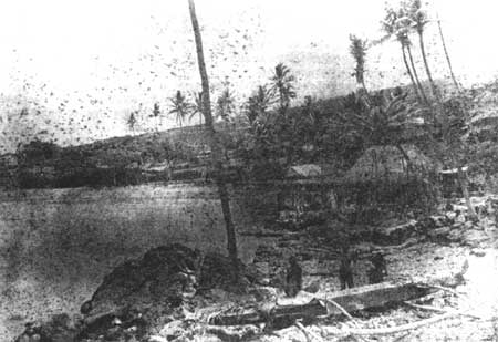
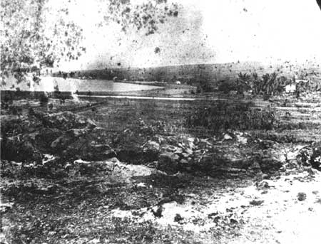
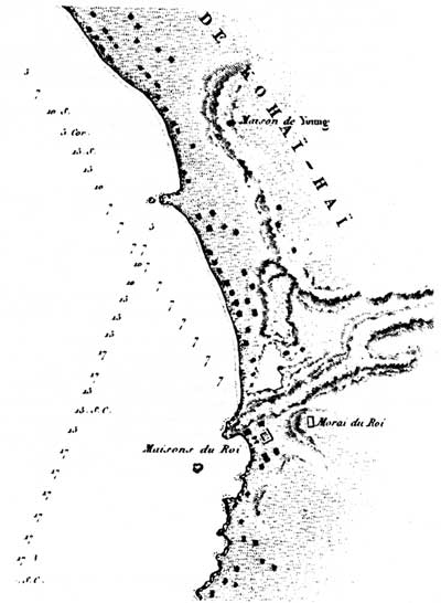
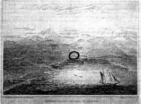
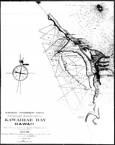
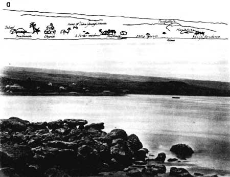
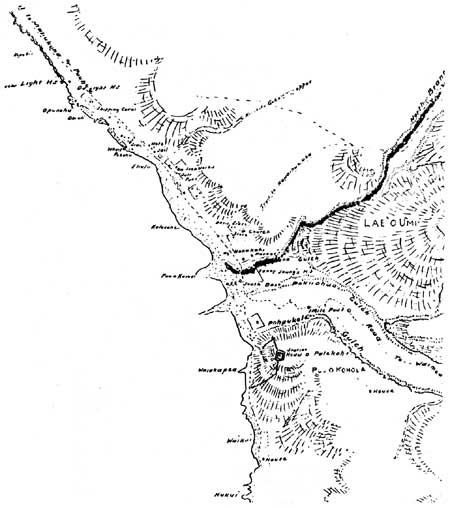
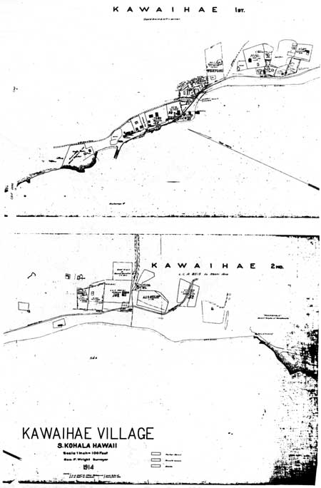
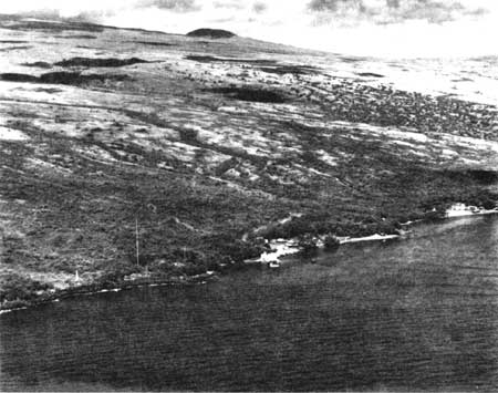
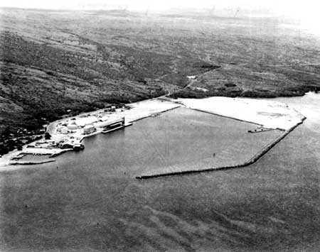
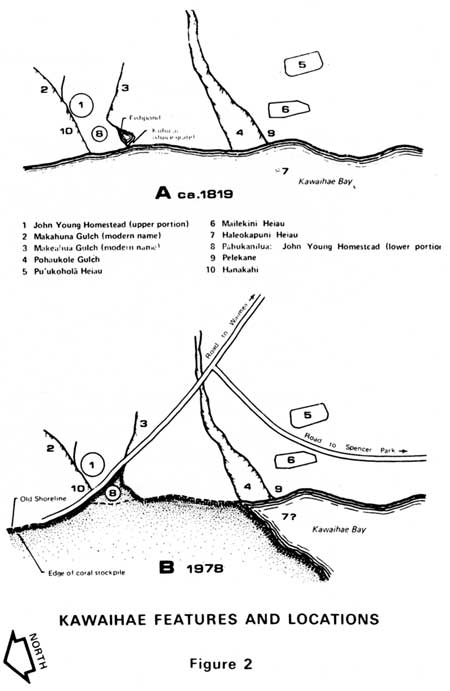

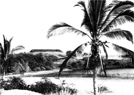
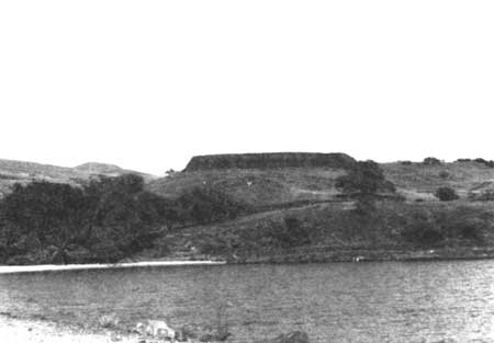
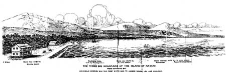
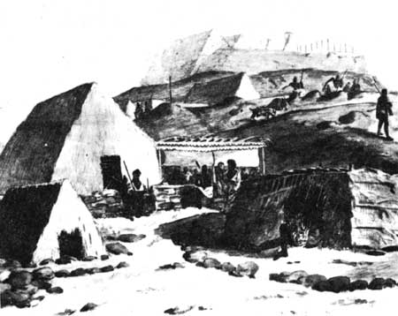
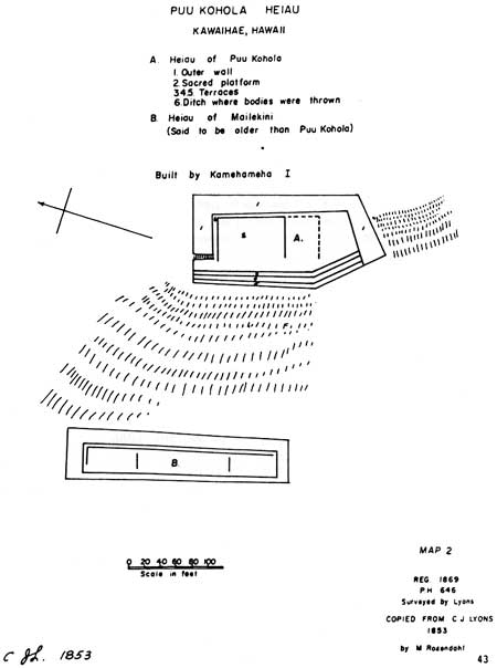

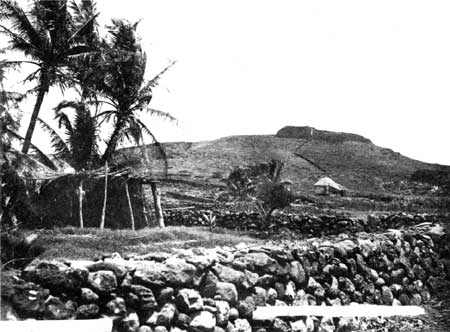
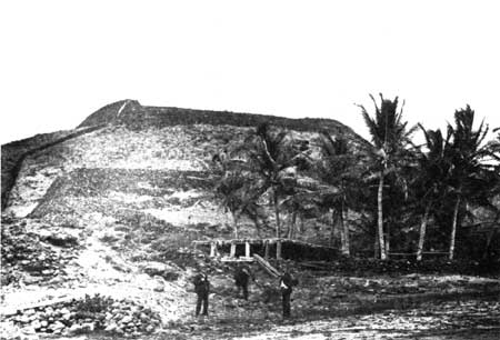
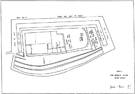
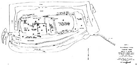
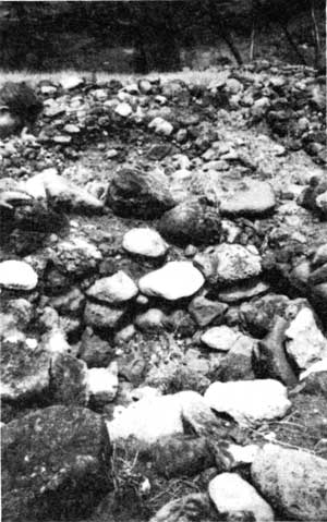
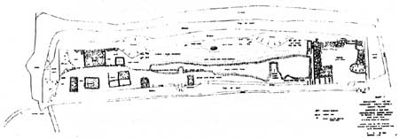
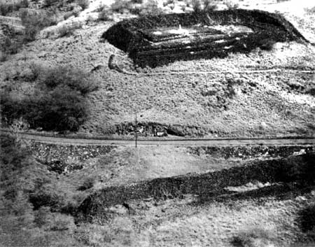
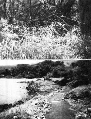
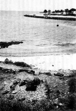
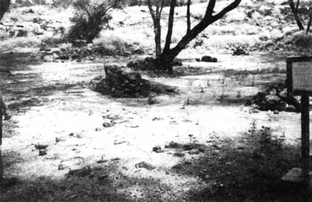
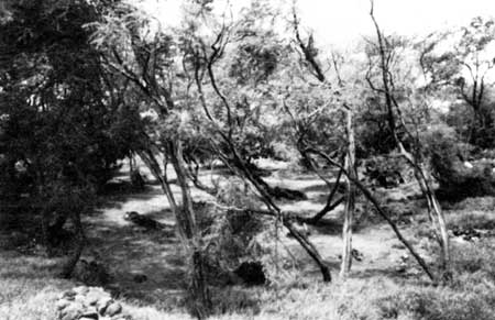
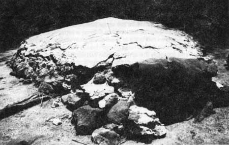
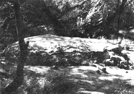
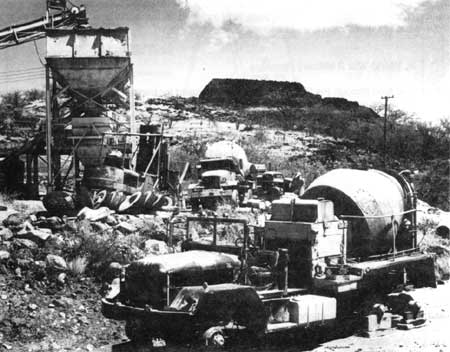
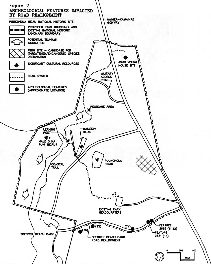
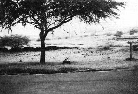
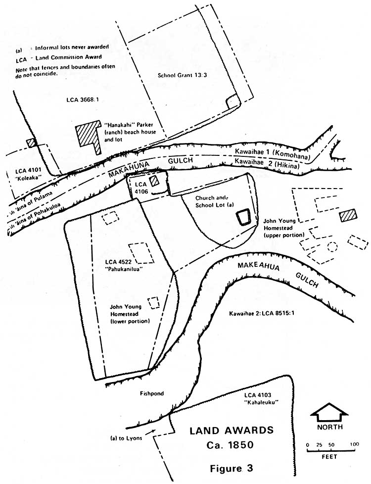
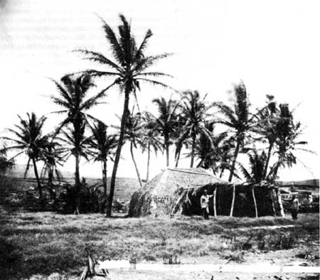
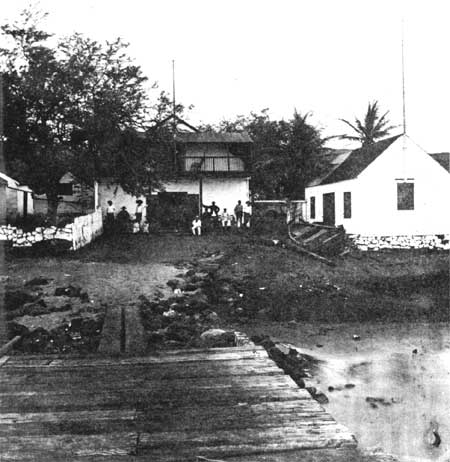
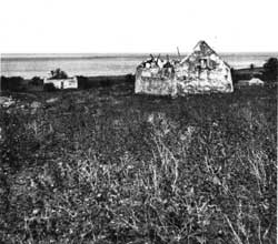
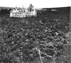
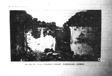
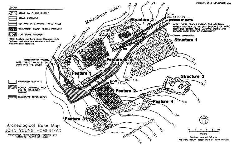
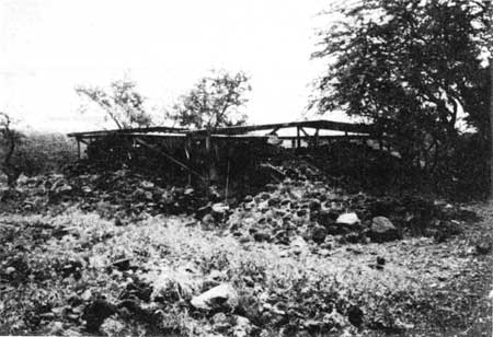
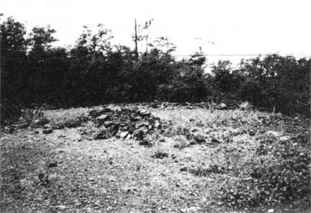
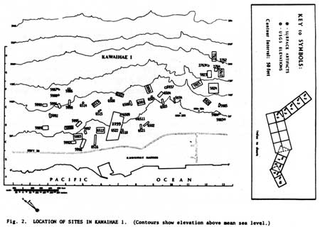
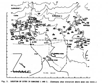
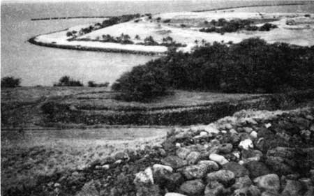
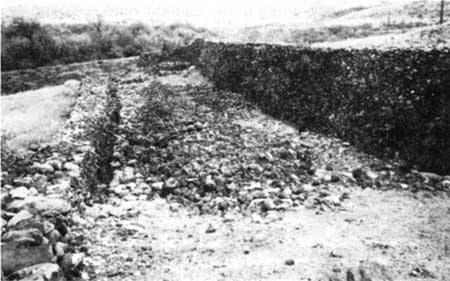
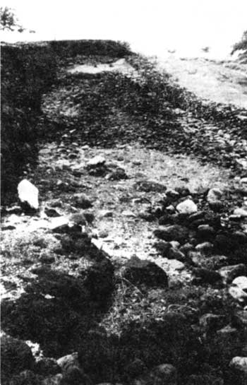
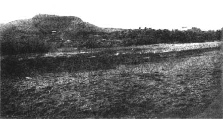
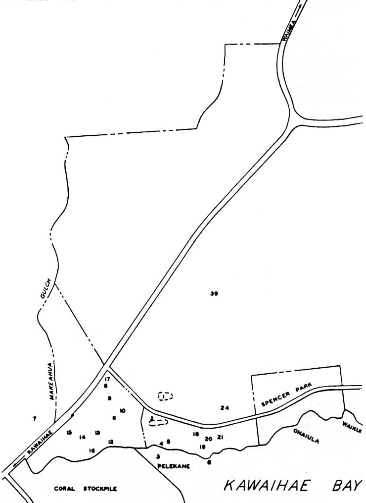
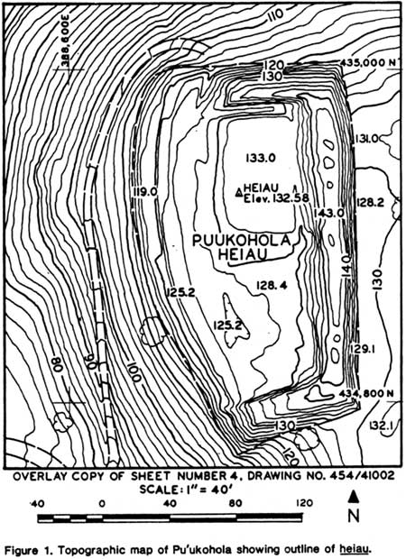
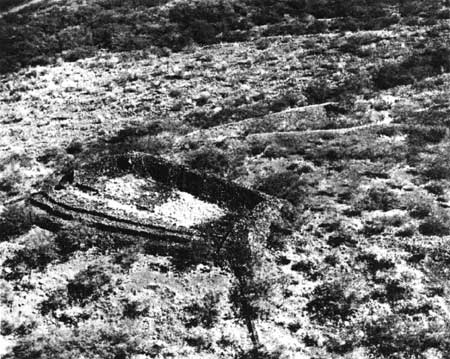
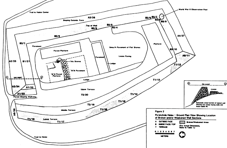
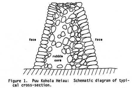
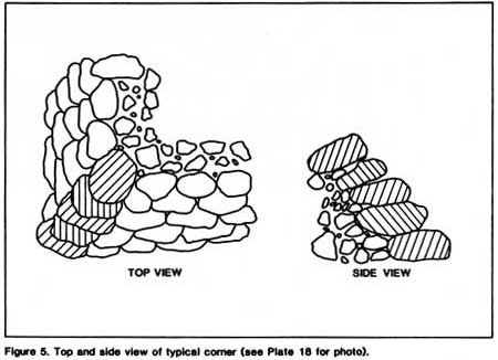
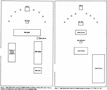
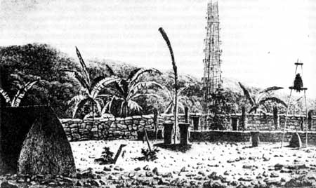
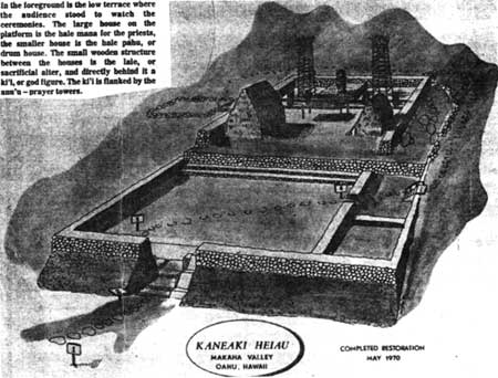
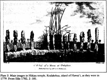
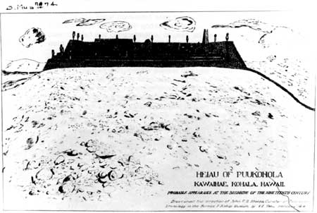
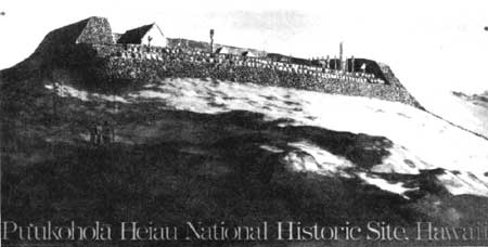
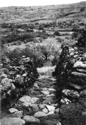
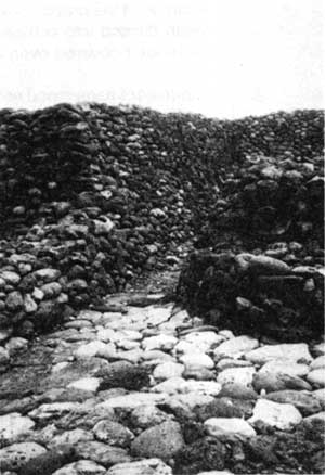
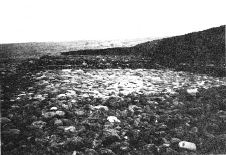
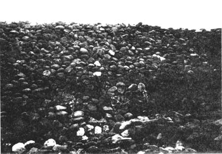
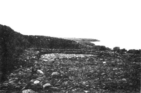
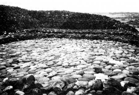
|
|
|
|
|
|
||
| History | Atlas | Culture | Language | Links |